Kaisborstel geodata
Kaisborstel (Schleswig-Holstein) is a seat of a fourth-order administrative division; located in Germany in Europe/Berlin (GMT+2) time zone. With population of 91 people, there are 10869 cities with bigger population in this country. Compared to other cities in Germany, 92.8% of cities are located further ↓South; 58% of cities are located further →East and 92% of cities have higher elevation than Kaisborstel. Note1
Administrative division(s):
- Level 1: Schleswig-Holstein
- Level 3: Kreis Steinburg
- Level 4: Kaisborstel


Kaisborstel GPS coordinates[2]
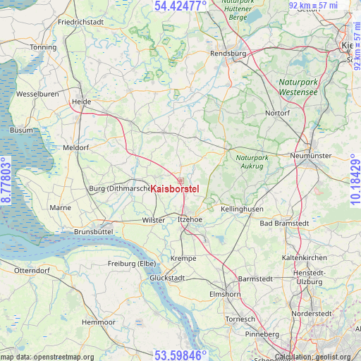
54° 0' 49.212" North, 9° 28' 52.176" East
| Map corner | latitude | longitude |
|---|---|---|
| Upper-left | 54.42477°, | 8.77803° |
| Center: | 54.01367°, | 9.48116° |
| Lower-right: | 53.59846°, | 10.18429° |
| Map W x H: | 91.9×91.9 km | = 57.1×57.1mi |
| max Lat: | 55.01917° ⇑7.2% North |
| Kaisborstel: | 54.01367° |
| min Lat: | ⇓92.8% South 47.40724° |
| min Long | Kaisborstel | max Long |
| 5.92978° | 9.48116° | 14.98853° |
| W 42%⇐ | ⇒58% E |
Elevation
Elevation of Kaisborstel is 16 m = 52 ft, and this is 233.1 m = 765 ft below average elevation for this country.
| Max E: |
1256 m = 4121 ft | 92% |
| Avg. | 249.1 m = 817 ft | |
| Kaisborstel | 16 m = 52 ft | |
Min E: |
-5 m = -16 ft | 8% |
See also: Germany elevation on elevation.city.
Geographical zone
Kaisborstel is located in North temperate zone (between Tropic of Cancer and the Arctic Circle). Distance of this North polar circle is 1395.4 km =867.1 mi to North.| Distance of | km | miles | from Kaisborstel |
|---|---|---|---|
| North Pole | 4001.3 | 2486.3 | to North |
| Arctic Circle | 1395.4 | 867.1 | to North |
| Tropic Cancer | 3399.8 | 2112.5 | to South |
| Equator | 6005.8 | 3731.8 | to South |


Nearby cities:
15 places around Kaisborstel: (largest is in red/bold)
• Agethorst
3 km =1.9 mi,  282°
282°
• Christinenthal
5.3 km =3.3 mi,  40°
40°
• Drage
2.7 km =1.7 mi,  113°
113°
• Hadenfeld
2.8 km =1.7 mi,  323°
323°
• Hohenaspe
4.1 km =2.5 mi,  132°
132°
• Huje
5.1 km =3.2 mi,  217°
217°
• Kaaks
2.7 km =1.7 mi,  196°
196°
• Looft
3.2 km =2 mi,  58°
58°
• Mehlbek
3.2 km =2 mi,  251°
251°
• Nienbüttel
4.7 km =2.9 mi,  292°
292°
• Oldenborstel
6.3 km =3.9 mi,  21°
21°
• Ottenbüttel
5 km =3.1 mi,  162°
162°
• Pöschendorf
2.7 km =1.7 mi,  10°
10°
• Schenefeld
4 km =2.5 mi,  2°
2°
• Vaale
6.6 km =4.1 mi,  256°
256°
Sources, notices
• [Note1] Compared only with cities in Germany existing in our database
• [Src1] Map data: © OpenStreetMap contributors (CC-BY-SA)
• [Src2] Other city data from geonames.org with taken over terms of usage.
• [Src3] Geographical zone / Annual Mean Temperature by Robert A. Rohde @ Wikipedia
