Geisingen geodata
Geisingen (Baden-Württemberg) is a populated place; located in Germany in Europe/Berlin (GMT+2) time zone. With population of 6,048 people, there are 2446 cities with bigger population in this country. Compared to other cities in Germany, 96.4% of cities are located further ↑North; 69.6% of cities are located further →East and 97.4% of cities have lower elevation than Geisingen. Note1
Administrative division(s):
- Level 1: Baden-Württemberg
- Level 2: Freiburg Region
- Level 3: Landkreis Tuttlingen
- Level 4: Geisingen


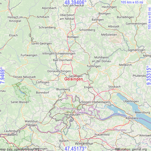
Geisingen GPS coordinates[2]
47° 55' 30.144" North, 8° 39' 0.072" East
| Map corner | latitude | longitude |
|---|---|---|
| Upper-left | 48.39406°, | 7.9469° |
| Center: | 47.92504°, | 8.65002° |
| Lower-right: | 47.45173°, | 9.35315° |
| Map W x H: | 104.8×104.8 km | = 65.1×65.1mi |
| max Lat: | 55.01917° ⇑96.4% North |
| Geisingen: | 47.92504° |
| min Lat: | ⇓3.6% South 47.40724° |
| min Long | Geisingen | max Long |
| 5.92978° | 8.65002° | 14.98853° |
| W 30.4%⇐ | ⇒69.6% E |
Elevation
Elevation of Geisingen is 680 m = 2231 ft, and this is 430.9 m = 1414 ft above average elevation for this country.
| Max E: |
1256 m = 4121 ft | 2.6% |
| Geisingen | 680 m 2231 ft | |
| Avg. | 249.1 m = 817 ft | |
Min E: |
-5 m = -16 ft | 97.4% |
See also: Germany elevation on elevation.city.
Geographical zone
Geisingen is located in North temperate zone (between Tropic of Cancer and the Arctic Circle). Distance of this North polar circle is 2072.4 km =1287.7 mi to North.| Distance of | km | miles | from Geisingen |
|---|---|---|---|
| North Pole | 4678.3 | 2907 | to North |
| Arctic Circle | 2072.4 | 1287.7 | to North |
| Tropic Cancer | 2722.8 | 1691.9 | to South |
| Equator | 5328.8 | 3311.2 | to South |


Nearby cities:
15 places around Geisingen: (largest is in red/bold)
• Bad Dürrheim
13.9 km =8.6 mi,  320°
320°
• Blumberg
12.8 km =8 mi,  222°
222°
• Donaueschingen
11.9 km =7.4 mi,  286°
286°
• Durchhausen
12.9 km =8 mi,  8°
8°
• Engen
12 km =7.5 mi,  130°
130°
• Hausen
2.1 km =1.3 mi,  119°
119°
• Hüfingen
12 km =7.5 mi,  270°
270°
• Immendingen
6.3 km =3.9 mi,  81°
81°
• Neuhausen
13.4 km =8.3 mi,  136°
136°
• Rietheim-Weilheim
13.4 km =8.3 mi,  40°
40°
• Seitingen-Oberflacht
11.3 km =7 mi,  25°
25°
• Talheim
10.3 km =6.4 mi, 6°
• Tengen
11.6 km =7.2 mi,  175°
175°
• Tuningen
12.6 km =7.8 mi,  342°
342°
• Wurmlingen
13 km =8.1 mi,  49°
49°
Sources, notices
• [Note1] Compared only with cities in Germany existing in our database
• [Src1] Map data: © OpenStreetMap contributors (CC-BY-SA)
• [Src2] Other city data from geonames.org with taken over terms of usage.
• [Src3] Geographical zone / Annual Mean Temperature by Robert A. Rohde @ Wikipedia
