Wallhausen geodata
Wallhausen (Saxony-Anhalt) is a seat of a fourth-order administrative division; located in Germany in Europe/Berlin (GMT+2) time zone. With population of 2,189 people, there are 4821 cities with bigger population in this country. Compared to other cities in Germany, 65.7% of cities are located further ↓South; 70.1% of cities are located further ←West and 61.3% of cities have higher elevation than Wallhausen. Note1


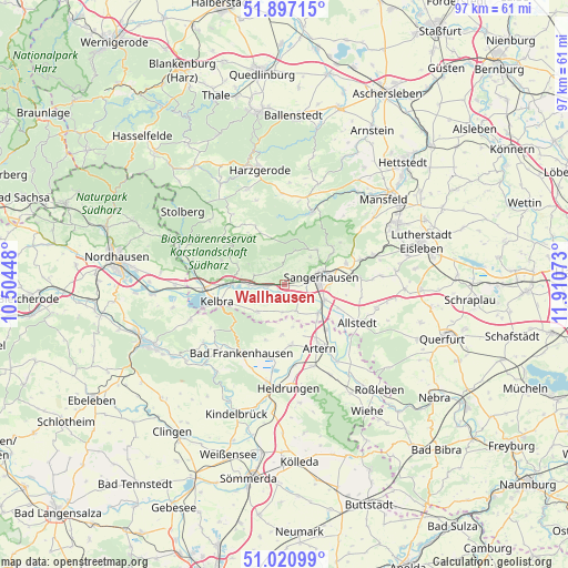
Wallhausen GPS coordinates[2]
51° 27' 40.212" North, 11° 12' 27.36" East
| Map corner | latitude | longitude |
|---|---|---|
| Upper-left | 51.89715°, | 10.50448° |
| Center: | 51.46117°, | 11.2076° |
| Lower-right: | 51.02099°, | 11.91073° |
| Map W x H: | 97.4×97.4 km | = 60.5×60.5mi |
| max Lat: | 55.01917° ⇑34.3% North |
| Wallhausen: | 51.46117° |
| min Lat: | ⇓65.7% South 47.40724° |
| min Long | Wallhausen | max Long |
| 5.92978° | 11.2076° | 14.98853° |
| W 70.1%⇐ | ⇒29.9% E |
Elevation
Elevation of Wallhausen is 144 m = 472 ft, and this is 105.1 m = 345 ft below average elevation for this country.
| Max E: |
1256 m = 4121 ft | 61.3% |
| Avg. | 249.1 m = 817 ft | |
| Wallhausen | 144 m = 472 ft | |
Min E: |
-5 m = -16 ft | 38.7% |
See also: Germany elevation on elevation.city.
Geographical zone
Wallhausen is located in North temperate zone (between Tropic of Cancer and the Arctic Circle). Distance of this North polar circle is 1679.2 km =1043.4 mi to North.| Distance of | km | miles | from Wallhausen |
|---|---|---|---|
| North Pole | 4285.1 | 2662.6 | to North |
| Arctic Circle | 1679.2 | 1043.4 | to North |
| Tropic Cancer | 3116 | 1936.2 | to South |
| Equator | 5721.9 | 3555.4 | to South |


Nearby cities:
15 places around Wallhausen: (largest is in red/bold)
• Bennungen
6.2 km =3.9 mi,  269°
269°
• Borxleben
7 km =4.3 mi,  165°
165°
• Brücken
2 km =1.2 mi,  199°
199°
• Edersleben
7.2 km =4.5 mi,  133°
133°
• Gonna
9.7 km =6 mi,  56°
56°
• Ichstedt
8.7 km =5.4 mi,  183°
183°
• Oberröblingen
7.4 km =4.6 mi,  111°
111°
• Obersdorf
10.5 km =6.5 mi,  50°
50°
• Riethnordhausen
4.9 km =3 mi,  155°
155°
• Ringleben
10.5 km =6.5 mi, 176°
• Roßla
9.1 km =5.7 mi, 271°
• Sangerhausen
6.2 km =3.9 mi,  78°
78°
• Tilleda
6.5 km =4 mi,  225°
225°
• Voigtstedt
10.4 km =6.5 mi,  137°
137°
• Wettelrode
8.2 km =5.1 mi,  42°
42°
Sources, notices
• [Note1] Compared only with cities in Germany existing in our database
• [Src1] Map data: © OpenStreetMap contributors (CC-BY-SA)
• [Src2] Other city data from geonames.org with taken over terms of usage.
• [Src3] Geographical zone / Annual Mean Temperature by Robert A. Rohde @ Wikipedia
