Hornbach geodata
Hornbach (Rheinland-Pfalz) is a populated place; located in Germany in Europe/Berlin (GMT+2) time zone. With population of 1,717 people, there are 5483 cities with bigger population in this country. Compared to other cities in Germany, 80.5% of cities are located further ↑North; 88.9% of cities are located further →East and 52% of cities have lower elevation than Hornbach. Note1


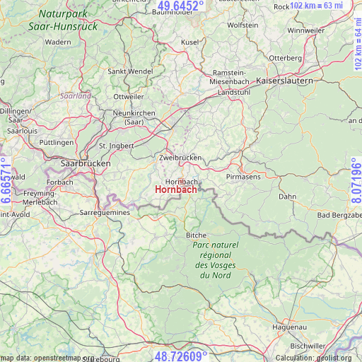
Hornbach GPS coordinates[2]
49° 11' 16.008" North, 7° 22' 7.788" East
| Map corner | latitude | longitude |
|---|---|---|
| Upper-left | 49.6452°, | 6.66571° |
| Center: | 49.18778°, | 7.36883° |
| Lower-right: | 48.72609°, | 8.07196° |
| Map W x H: | 102.2×102.2 km | = 63.5×63.5mi |
| max Lat: | 55.01917° ⇑80.5% North |
| Hornbach: | 49.18778° |
| min Lat: | ⇓19.5% South 47.40724° |
| min Long | Hornbach | max Long |
| 5.92978° | 7.36883° | 14.98853° |
| W 11.1%⇐ | ⇒88.9% E |
Elevation
Elevation of Hornbach is 240 m = 787 ft, and this is 9.1 m = 30 ft below average elevation for this country.
| Max E: |
1256 m = 4121 ft | 48% |
| Avg. | 249.1 m = 817 ft | |
| Hornbach | 240 m = 787 ft | |
Min E: |
-5 m = -16 ft | 52% |
See also: Germany elevation on elevation.city.
Geographical zone
Hornbach is located in North temperate zone (between Tropic of Cancer and the Arctic Circle). Distance of this North polar circle is 1932 km =1200.5 mi to North.| Distance of | km | miles | from Hornbach |
|---|---|---|---|
| North Pole | 4537.9 | 2819.7 | to North |
| Arctic Circle | 1932 | 1200.5 | to North |
| Tropic Cancer | 2863.2 | 1779.1 | to South |
| Equator | 5469.2 | 3398.4 | to South |


Nearby cities:
15 places around Hornbach: (largest is in red/bold)
• Althornbach
1.8 km =1.1 mi,  14°
14°
• Blieskastel
9.9 km =6.2 mi,  303°
303°
• Bottenbach
9.5 km =5.9 mi,  92°
92°
• Contwig
8.4 km =5.2 mi,  34°
34°
• Dellfeld
9.2 km =5.7 mi,  56°
56°
• Dietrichingen
3.5 km =2.2 mi,  98°
98°
• Großsteinhausen
5.9 km =3.7 mi, 94°
• Kleinsteinhausen
7.2 km =4.5 mi,  79°
79°
• Mauschbach
2.3 km =1.4 mi, 102°
• Nünschweiler
10.8 km =6.7 mi,  68°
68°
• Riedelberg
5.9 km =3.7 mi, 94°
• Rieschweiler-Mühlbach
10.8 km =6.7 mi, 62°
• Rimschweiler
3.5 km =2.2 mi, 8°
• Walshausen
8.9 km =5.5 mi, 68°
• Zweibrücken
6.6 km =4.1 mi,  0°
0°
Sources, notices
• [Note1] Compared only with cities in Germany existing in our database
• [Src1] Map data: © OpenStreetMap contributors (CC-BY-SA)
• [Src2] Other city data from geonames.org with taken over terms of usage.
• [Src3] Geographical zone / Annual Mean Temperature by Robert A. Rohde @ Wikipedia
