Contwig geodata
Contwig (Rheinland-Pfalz) is a seat of a fourth-order administrative division; located in Germany in Europe/Berlin (GMT+2) time zone. With population of 5,029 people, there are 2815 cities with bigger population in this country. Compared to other cities in Germany, 79.5% of cities are located further ↑North; 88.2% of cities are located further →East and 54.7% of cities have lower elevation than Contwig. Note1


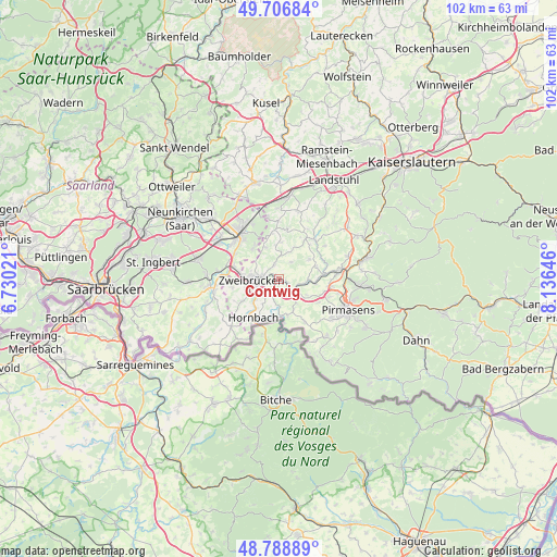
Contwig GPS coordinates[2]
49° 15' 0" North, 7° 25' 59.988" East
| Map corner | latitude | longitude |
|---|---|---|
| Upper-left | 49.70684°, | 6.73021° |
| Center: | 49.25°, | 7.43333° |
| Lower-right: | 48.78889°, | 8.13646° |
| Map W x H: | 102.1×102.1 km | = 63.4×63.4mi |
| max Lat: | 55.01917° ⇑79.5% North |
| Contwig: | 49.25° |
| min Lat: | ⇓20.5% South 47.40724° |
| min Long | Contwig | max Long |
| 5.92978° | 7.43333° | 14.98853° |
| W 11.8%⇐ | ⇒88.2% E |
Elevation
Elevation of Contwig is 256 m = 840 ft, and this is 6.9 m = 23 ft above average elevation for this country.
| Max E: |
1256 m = 4121 ft | 45.3% |
| Contwig | 256 m 840 ft | |
| Avg. | 249.1 m = 817 ft | |
Min E: |
-5 m = -16 ft | 54.7% |
See also: Germany elevation on elevation.city.
Geographical zone
Contwig is located in North temperate zone (between Tropic of Cancer and the Arctic Circle). Distance of this North polar circle is 1925.1 km =1196.2 mi to North.| Distance of | km | miles | from Contwig |
|---|---|---|---|
| North Pole | 4531 | 2815.4 | to North |
| Arctic Circle | 1925.1 | 1196.2 | to North |
| Tropic Cancer | 2870.2 | 1783.5 | to South |
| Equator | 5476.1 | 3402.7 | to South |


Nearby cities:
15 places around Contwig: (largest is in red/bold)
• Althornbach
6.7 km =4.2 mi,  219°
219°
• Battweiler
3.9 km =2.4 mi,  34°
34°
• Dellfeld
3.4 km =2.1 mi,  121°
121°
• Großbundenbach
5.7 km =3.5 mi,  347°
347°
• Kleinbundenbach
7.4 km =4.6 mi,  0°
0°
• Kleinsteinhausen
6.1 km =3.8 mi,  156°
156°
• Maßweiler
7.5 km =4.7 mi,  75°
75°
• Nünschweiler
6.1 km =3.8 mi, 118°
• Reifenberg
6.6 km =4.1 mi,  56°
56°
• Riedelberg
7.5 km =4.7 mi,  170°
170°
• Rieschweiler-Mühlbach
5.2 km =3.2 mi,  110°
110°
• Rimschweiler
5.4 km =3.4 mi,  230°
230°
• Walshausen
5.2 km =3.2 mi,  135°
135°
• Winterbach
6.6 km =4.1 mi, 26°
• Zweibrücken
4.6 km =2.9 mi,  265°
265°
Sources, notices
• [Note1] Compared only with cities in Germany existing in our database
• [Src1] Map data: © OpenStreetMap contributors (CC-BY-SA)
• [Src2] Other city data from geonames.org with taken over terms of usage.
• [Src3] Geographical zone / Annual Mean Temperature by Robert A. Rohde @ Wikipedia
