Blieskastel geodata
Blieskastel (Saarland) is a populated place; located in Germany in Europe/Berlin (GMT+2) time zone. With population of 23,212 people, there are 640 cities with bigger population in this country. Compared to other cities in Germany, 79.8% of cities are located further ↑North; 90.6% of cities are located further →East and 52.3% of cities have lower elevation than Blieskastel. Note1


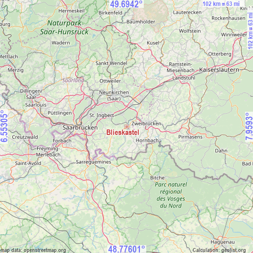
Blieskastel GPS coordinates[2]
49° 14' 14.064" North, 7° 15' 22.212" East
| Map corner | latitude | longitude |
|---|---|---|
| Upper-left | 49.6942°, | 6.55305° |
| Center: | 49.23724°, | 7.25617° |
| Lower-right: | 48.77601°, | 7.9593° |
| Map W x H: | 102.1×102.1 km | = 63.4×63.4mi |
| max Lat: | 55.01917° ⇑79.8% North |
| Blieskastel: | 49.23724° |
| min Lat: | ⇓20.2% South 47.40724° |
| min Long | Blieskastel | max Long |
| 5.92978° | 7.25617° | 14.98853° |
| W 9.4%⇐ | ⇒90.6% E |
Elevation
Elevation of Blieskastel is 242 m = 794 ft, and this is 7.1 m = 23 ft below average elevation for this country.
| Max E: |
1256 m = 4121 ft | 47.7% |
| Avg. | 249.1 m = 817 ft | |
| Blieskastel | 242 m = 794 ft | |
Min E: |
-5 m = -16 ft | 52.3% |
See also: Germany elevation on elevation.city.
Geographical zone
Blieskastel is located in North temperate zone (between Tropic of Cancer and the Arctic Circle). Distance of this North polar circle is 1926.5 km =1197.1 mi to North.| Distance of | km | miles | from Blieskastel |
|---|---|---|---|
| North Pole | 4532.4 | 2816.3 | to North |
| Arctic Circle | 1926.5 | 1197.1 | to North |
| Tropic Cancer | 2868.7 | 1782.5 | to South |
| Equator | 5474.7 | 3401.8 | to South |


Nearby cities:
15 places around Blieskastel: (largest is in red/bold)
• Althornbach
9.4 km =5.8 mi,  113°
113°
• Bexbach
12.1 km =7.5 mi,  359°
359°
• Contwig
12.9 km =8 mi,  83°
83°
• Dietrichingen
13.1 km =8.1 mi,  117°
117°
• Gersheim
10.5 km =6.5 mi,  202°
202°
• Großbundenbach
13.6 km =8.5 mi,  59°
59°
• Homburg
11.6 km =7.2 mi,  31°
31°
• Hornbach
9.9 km =6.2 mi, 123°
• Kirkel
5.4 km =3.4 mi,  342°
342°
• Mauschbach
12 km =7.5 mi, 119°
• Neunkirchen
13.1 km =8.1 mi, 335°
• Rimschweiler
8.9 km =5.5 mi,  103°
103°
• Sankt Ingbert
11 km =6.8 mi,  293°
293°
• Spiesen-Elversberg
12.5 km =7.8 mi,  314°
314°
• Zweibrücken
8.3 km =5.2 mi, 82°
Sources, notices
• [Note1] Compared only with cities in Germany existing in our database
• [Src1] Map data: © OpenStreetMap contributors (CC-BY-SA)
• [Src2] Other city data from geonames.org with taken over terms of usage.
• [Src3] Geographical zone / Annual Mean Temperature by Robert A. Rohde @ Wikipedia
