Althornbach geodata
Althornbach (Rheinland-Pfalz) is a seat of a fourth-order administrative division; located in Germany in Europe/Berlin (GMT+2) time zone. With population of 789 people, there are 7949 cities with bigger population in this country. Compared to other cities in Germany, 80.2% of cities are located further ↑North; 88.9% of cities are located further →East and 51.4% of cities have lower elevation than Althornbach. Note1


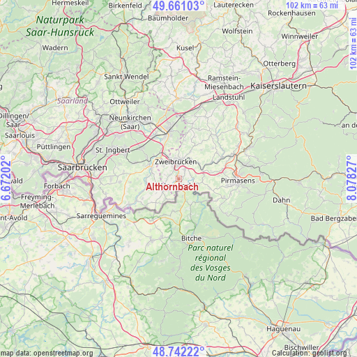
Althornbach GPS coordinates[2]
49° 12' 13.536" North, 7° 22' 30.54" East
| Map corner | latitude | longitude |
|---|---|---|
| Upper-left | 49.66103°, | 6.67202° |
| Center: | 49.20376°, | 7.37515° |
| Lower-right: | 48.74222°, | 8.07827° |
| Map W x H: | 102.2×102.2 km | = 63.5×63.5mi |
| max Lat: | 55.01917° ⇑80.2% North |
| Althornbach: | 49.20376° |
| min Lat: | ⇓19.8% South 47.40724° |
| min Long | Althornbach | max Long |
| 5.92978° | 7.37515° | 14.98853° |
| W 11.1%⇐ | ⇒88.9% E |
Elevation
Elevation of Althornbach is 236 m = 774 ft, and this is 13.1 m = 43 ft below average elevation for this country.
| Max E: |
1256 m = 4121 ft | 48.6% |
| Avg. | 249.1 m = 817 ft | |
| Althornbach | 236 m = 774 ft | |
Min E: |
-5 m = -16 ft | 51.4% |
See also: Germany elevation on elevation.city.
Geographical zone
Althornbach is located in North temperate zone (between Tropic of Cancer and the Arctic Circle). Distance of this North polar circle is 1930.2 km =1199.4 mi to North.| Distance of | km | miles | from Althornbach |
|---|---|---|---|
| North Pole | 4536.1 | 2818.6 | to North |
| Arctic Circle | 1930.2 | 1199.4 | to North |
| Tropic Cancer | 2865 | 1780.2 | to South |
| Equator | 5470.9 | 3399.5 | to South |


Nearby cities:
15 places around Althornbach: (largest is in red/bold)
• Blieskastel
9.4 km =5.8 mi,  293°
293°
• Bottenbach
9.4 km =5.8 mi,  104°
104°
• Contwig
6.7 km =4.2 mi,  39°
39°
• Dellfeld
7.9 km =4.9 mi,  64°
64°
• Dietrichingen
3.8 km =2.4 mi,  126°
126°
• Großsteinhausen
5.9 km =3.7 mi,  112°
112°
• Hornbach
1.8 km =1.1 mi,  194°
194°
• Kleinsteinhausen
6.7 km =4.2 mi,  93°
93°
• Mauschbach
2.9 km =1.8 mi,  141°
141°
• Nünschweiler
9.8 km =6.1 mi,  77°
77°
• Riedelberg
5.9 km =3.7 mi, 112°
• Rieschweiler-Mühlbach
9.6 km =6 mi,  70°
70°
• Rimschweiler
1.7 km =1.1 mi,  1°
1°
• Walshausen
8 km =5 mi, 79°
• Zweibrücken
4.8 km =3 mi,  355°
355°
Sources, notices
• [Note1] Compared only with cities in Germany existing in our database
• [Src1] Map data: © OpenStreetMap contributors (CC-BY-SA)
• [Src2] Other city data from geonames.org with taken over terms of usage.
• [Src3] Geographical zone / Annual Mean Temperature by Robert A. Rohde @ Wikipedia
