Hohenwarth geodata
Hohenwarth (Bavaria) is a seat of a fourth-order administrative division; located in Germany in Europe/Berlin (GMT+2) time zone. With population of 2,132 people, there are 4887 cities with bigger population in this country. Compared to other cities in Germany, 80.3% of cities are located further ↑North; 91.7% of cities are located further ←West and 91.3% of cities have lower elevation than Hohenwarth. Note1
Administrative division(s):
- Level 1: Bavaria
- Level 2: Upper Palatinate
- Level 3: Landkreis Cham
- Level 4: Hohenwarth


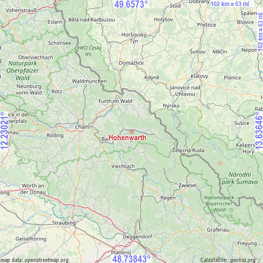
Hohenwarth GPS coordinates[2]
49° 12' 0" North, 12° 55' 59.988" East
| Map corner | latitude | longitude |
|---|---|---|
| Upper-left | 49.6573°, | 12.23021° |
| Center: | 49.2°, | 12.93333° |
| Lower-right: | 48.73843°, | 13.63646° |
| Map W x H: | 102.2×102.2 km | = 63.5×63.5mi |
| max Lat: | 55.01917° ⇑80.3% North |
| Hohenwarth: | 49.2° |
| min Lat: | ⇓19.7% South 47.40724° |
| min Long | Hohenwarth | max Long |
| 5.92978° | 12.93333° | 14.98853° |
| W 91.7%⇐ | ⇒8.3% E |
Elevation
Elevation of Hohenwarth is 532 m = 1745 ft, and this is 282.9 m = 928 ft above average elevation for this country.
| Max E: |
1256 m = 4121 ft | 8.7% |
| Hohenwarth | 532 m 1745 ft | |
| Avg. | 249.1 m = 817 ft | |
Min E: |
-5 m = -16 ft | 91.3% |
See also: Germany elevation on elevation.city.
Geographical zone
Hohenwarth is located in North temperate zone (between Tropic of Cancer and the Arctic Circle). Distance of this North polar circle is 1930.6 km =1199.6 mi to North.| Distance of | km | miles | from Hohenwarth |
|---|---|---|---|
| North Pole | 4536.5 | 2818.8 | to North |
| Arctic Circle | 1930.6 | 1199.6 | to North |
| Tropic Cancer | 2864.6 | 1780 | to South |
| Equator | 5470.5 | 3399.2 | to South |


Nearby cities:
15 places around Hohenwarth: (largest is in red/bold)
• Arnbruck
9.1 km =5.7 mi,  148°
148°
• Arnschwang
12.1 km =7.5 mi,  314°
314°
• Arrach
4.5 km =2.8 mi,  102°
102°
• Blaibach
9.3 km =5.8 mi,  246°
246°
• Chamerau
13.3 km =8.3 mi,  270°
270°
• Drachselsried
11.8 km =7.3 mi, 150°
• Eschlkam
11.1 km =6.9 mi,  353°
353°
• Grafenwiesen
3.6 km =2.2 mi, 270°
• Kötzting
6.3 km =3.9 mi, 245°
• Lam
8.5 km =5.3 mi,  92°
92°
• Lohberg
12.8 km =8 mi, 102°
• Miltach
12.7 km =7.9 mi, 250°
• Neukirchen
7.2 km =4.5 mi,  21°
21°
• Rimbach
5.2 km =3.2 mi,  315°
315°
• Runding
12.6 km =7.8 mi,  277°
277°
Sources, notices
• [Note1] Compared only with cities in Germany existing in our database
• [Src1] Map data: © OpenStreetMap contributors (CC-BY-SA)
• [Src2] Other city data from geonames.org with taken over terms of usage.
• [Src3] Geographical zone / Annual Mean Temperature by Robert A. Rohde @ Wikipedia
