Arrach geodata
Arrach (Bavaria) is a seat of a fourth-order administrative division; located in Germany in Europe/Berlin (GMT+2) time zone. With population of 2,769 people, there are 4180 cities with bigger population in this country. Compared to other cities in Germany, 80.5% of cities are located further ↑North; 92.3% of cities are located further ←West and 91.4% of cities have lower elevation than Arrach. Note1
Administrative division(s):
- Level 1: Bavaria
- Level 2: Upper Palatinate
- Level 3: Landkreis Cham
- Level 4: Arrach


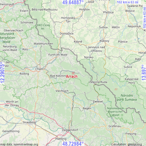
Arrach GPS coordinates[2]
49° 11' 29.364" North, 12° 59' 37.932" East
| Map corner | latitude | longitude |
|---|---|---|
| Upper-left | 49.64887°, | 12.29075° |
| Center: | 49.19149°, | 12.99387° |
| Lower-right: | 48.72984°, | 13.697° |
| Map W x H: | 102.2×102.2 km | = 63.5×63.5mi |
| max Lat: | 55.01917° ⇑80.5% North |
| Arrach: | 49.19149° |
| min Lat: | ⇓19.5% South 47.40724° |
| min Long | Arrach | max Long |
| 5.92978° | 12.99387° | 14.98853° |
| W 92.3%⇐ | ⇒7.7% E |
Elevation
Elevation of Arrach is 534 m = 1752 ft, and this is 284.9 m = 935 ft above average elevation for this country.
| Max E: |
1256 m = 4121 ft | 8.6% |
| Arrach | 534 m 1752 ft | |
| Avg. | 249.1 m = 817 ft | |
Min E: |
-5 m = -16 ft | 91.4% |
See also: Germany elevation on elevation.city.
Geographical zone
Arrach is located in North temperate zone (between Tropic of Cancer and the Arctic Circle). Distance of this North polar circle is 1931.6 km =1200.2 mi to North.| Distance of | km | miles | from Arrach |
|---|---|---|---|
| North Pole | 4537.5 | 2819.5 | to North |
| Arctic Circle | 1931.6 | 1200.2 | to North |
| Tropic Cancer | 2863.7 | 1779.4 | to South |
| Equator | 5469.6 | 3398.7 | to South |


Nearby cities:
15 places around Arrach: (largest is in red/bold)
• Arnbruck
6.8 km =4.2 mi,  177°
177°
• Arnschwang
16 km =9.9 mi,  306°
306°
• Blaibach
13.2 km =8.2 mi,  257°
257°
• Bodenmais
15.9 km =9.9 mi,  150°
150°
• Böbrach
15.3 km =9.5 mi,  168°
168°
• Drachselsried
9.4 km =5.8 mi, 172°
• Eschlkam
13.2 km =8.2 mi,  334°
334°
• Grafenwiesen
8.1 km =5 mi,  276°
276°
• Hohenwarth
4.5 km =2.8 mi, 282°
• Kötzting
10.2 km =6.3 mi, 260°
• Lam
4.2 km =2.6 mi,  82°
82°
• Lohberg
8.3 km =5.2 mi,  101°
101°
• Neukirchen
7.8 km =4.8 mi,  346°
346°
• Rimbach
9.3 km =5.8 mi,  300°
300°
• Viechtach
14.7 km =9.1 mi,  212°
212°
Sources, notices
• [Note1] Compared only with cities in Germany existing in our database
• [Src1] Map data: © OpenStreetMap contributors (CC-BY-SA)
• [Src2] Other city data from geonames.org with taken over terms of usage.
• [Src3] Geographical zone / Annual Mean Temperature by Robert A. Rohde @ Wikipedia
