Eschlkam geodata
Eschlkam (Bavaria) is a populated place; located in Germany in Europe/Berlin (GMT+2) time zone. With population of 3,575 people, there are 3557 cities with bigger population in this country. Compared to other cities in Germany, 78.7% of cities are located further ↑North; 91.6% of cities are located further ←West and 84.1% of cities have lower elevation than Eschlkam. Note1
Administrative division(s):
- Level 1: Bavaria
- Level 2: Upper Palatinate
- Level 3: Landkreis Cham
- Level 4: Eschlkam, Markt


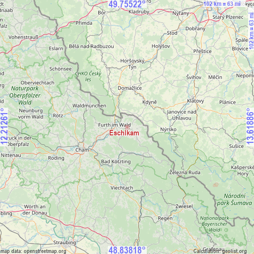
Eschlkam GPS coordinates[2]
49° 17' 55.788" North, 12° 54' 56.628" East
| Map corner | latitude | longitude |
|---|---|---|
| Upper-left | 49.75522°, | 12.21261° |
| Center: | 49.29883°, | 12.91573° |
| Lower-right: | 48.83818°, | 13.61886° |
| Map W x H: | 102×102 km | = 63.4×63.4mi |
| max Lat: | 55.01917° ⇑78.7% North |
| Eschlkam: | 49.29883° |
| min Lat: | ⇓21.3% South 47.40724° |
| min Long | Eschlkam | max Long |
| 5.92978° | 12.91573° | 14.98853° |
| W 91.6%⇐ | ⇒8.4% E |
Elevation
Elevation of Eschlkam is 462 m = 1516 ft, and this is 212.9 m = 698 ft above average elevation for this country.
| Max E: |
1256 m = 4121 ft | 15.9% |
| Eschlkam | 462 m 1516 ft | |
| Avg. | 249.1 m = 817 ft | |
Min E: |
-5 m = -16 ft | 84.1% |
See also: Germany elevation on elevation.city.
Geographical zone
Eschlkam is located in North temperate zone (between Tropic of Cancer and the Arctic Circle). Distance of this North polar circle is 1919.7 km =1192.8 mi to North.| Distance of | km | miles | from Eschlkam |
|---|---|---|---|
| North Pole | 4525.5 | 2812 | to North |
| Arctic Circle | 1919.7 | 1192.8 | to North |
| Tropic Cancer | 2875.6 | 1786.8 | to South |
| Equator | 5481.5 | 3406 | to South |


Nearby cities:
15 places around Eschlkam: (largest is in red/bold)
• Arnschwang
7.6 km =4.7 mi,  251°
251°
• Arrach
13.2 km =8.2 mi,  154°
154°
• Blaibach
16.4 km =10.2 mi,  206°
206°
• Chamerau
16.3 km =10.1 mi,  227°
227°
• Furth im Wald
5.5 km =3.4 mi,  282°
282°
• Gleißenberg
13.4 km =8.3 mi, 278°
• Grafenwiesen
11.2 km =7 mi,  192°
192°
• Hohenwarth
11.1 km =6.9 mi,  173°
173°
• Kötzting
14.3 km =8.9 mi,  197°
197°
• Lam
15 km =9.3 mi,  139°
139°
• Neukirchen
5.8 km =3.6 mi, 137°
• Rimbach
7.7 km =4.8 mi, 197°
• Runding
14.5 km =9 mi, 230°
• Waldmünchen
17.4 km =10.8 mi,  300°
300°
• Weiding
11.8 km =7.3 mi, 250°
Sources, notices
• [Note1] Compared only with cities in Germany existing in our database
• [Src1] Map data: © OpenStreetMap contributors (CC-BY-SA)
• [Src2] Other city data from geonames.org with taken over terms of usage.
• [Src3] Geographical zone / Annual Mean Temperature by Robert A. Rohde @ Wikipedia
