Hofstetten geodata
Hofstetten (Baden-Württemberg) is a seat of a fourth-order administrative division; located in Germany in Europe/Berlin (GMT+2) time zone. With population of 1,661 people, there are 5586 cities with bigger population in this country. Compared to other cities in Germany, 91.8% of cities are located further ↑North; 76% of cities are located further →East and 57.3% of cities have lower elevation than Hofstetten. Note1
Administrative division(s):
- Level 1: Baden-Württemberg
- Level 2: Freiburg Region
- Level 3: Ortenaukreis
- Level 4: Hofstetten


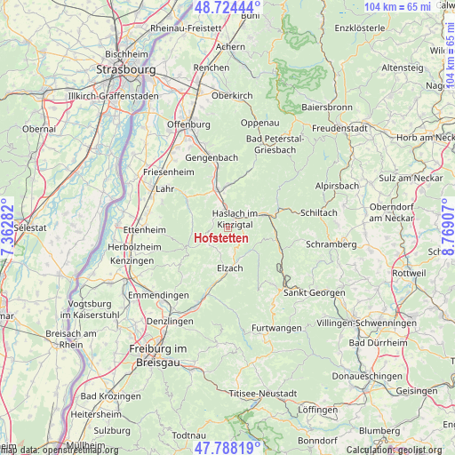
Hofstetten GPS coordinates[2]
48° 15' 30.456" North, 8° 3' 57.42" East
| Map corner | latitude | longitude |
|---|---|---|
| Upper-left | 48.72444°, | 7.36282° |
| Center: | 48.25846°, | 8.06595° |
| Lower-right: | 47.78819°, | 8.76907° |
| Map W x H: | 104.1×104.1 km | = 64.7×64.7mi |
| max Lat: | 55.01917° ⇑91.8% North |
| Hofstetten: | 48.25846° |
| min Lat: | ⇓8.2% South 47.40724° |
| min Long | Hofstetten | max Long |
| 5.92978° | 8.06595° | 14.98853° |
| W 24%⇐ | ⇒76% E |
Elevation
Elevation of Hofstetten is 274 m = 899 ft, and this is 24.9 m = 82 ft above average elevation for this country.
| Max E: |
1256 m = 4121 ft | 42.7% |
| Hofstetten | 274 m 899 ft | |
| Avg. | 249.1 m = 817 ft | |
Min E: |
-5 m = -16 ft | 57.3% |
See also: Germany elevation on elevation.city.
Geographical zone
Hofstetten is located in North temperate zone (between Tropic of Cancer and the Arctic Circle). Distance of this North polar circle is 2035.3 km =1264.7 mi to North.| Distance of | km | miles | from Hofstetten |
|---|---|---|---|
| North Pole | 4641.2 | 2883.9 | to North |
| Arctic Circle | 2035.3 | 1264.7 | to North |
| Tropic Cancer | 2759.9 | 1714.9 | to South |
| Equator | 5365.8 | 3334.2 | to South |


Nearby cities:
15 places around Hofstetten: (largest is in red/bold)
• Biberach
8.7 km =5.4 mi,  343°
343°
• Elzach
9.6 km =6 mi,  178°
178°
• Fischerbach
4.5 km =2.8 mi,  45°
45°
• Gutach
10.9 km =6.8 mi,  95°
95°
• Hausach
8.6 km =5.3 mi,  70°
70°
• Hohberg
14.2 km =8.8 mi,  300°
300°
• Hornberg
13.4 km =8.3 mi,  113°
113°
• Mühlenbach
3.9 km =2.4 mi, 104°
• Nordrach
15.8 km =9.8 mi,  4°
4°
• Oberharmersbach
13.5 km =8.4 mi,  18°
18°
• Oberwolfach
12.9 km =8 mi,  59°
59°
• Schuttertal
8.6 km =5.3 mi,  276°
276°
• Seelbach
10.9 km =6.8 mi, 302°
• Steinach
4.8 km =3 mi,  345°
345°
• Wolfach
11.7 km =7.3 mi, 70°
Sources, notices
• [Note1] Compared only with cities in Germany existing in our database
• [Src1] Map data: © OpenStreetMap contributors (CC-BY-SA)
• [Src2] Other city data from geonames.org with taken over terms of usage.
• [Src3] Geographical zone / Annual Mean Temperature by Robert A. Rohde @ Wikipedia
