Biberach geodata
Biberach (Baden-Württemberg) is a seat of a fourth-order administrative division; located in Germany in Europe/Berlin (GMT+2) time zone. In our database, there are 11009 cities with bigger population. Compared to other cities in Germany, 90.9% of cities are located further ↑North; 76.6% of cities are located further →East and 54.2% of cities have higher elevation than Biberach. Note1
Administrative division(s):
- Level 1: Baden-Württemberg
- Level 2: Freiburg Region
- Level 3: Ortenaukreis
- Level 4: Biberach


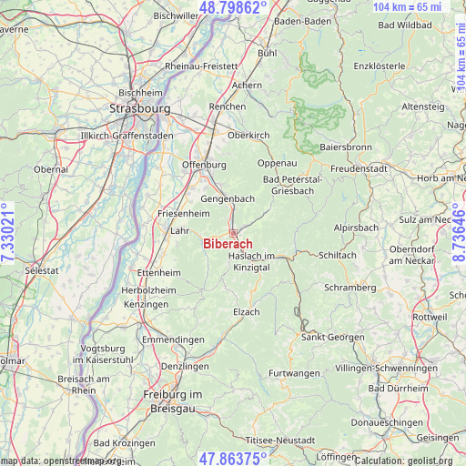
Biberach GPS coordinates[2]
48° 19' 59.988" North, 8° 1' 59.988" East
| Map corner | latitude | longitude |
|---|---|---|
| Upper-left | 48.79862°, | 7.33021° |
| Center: | 48.33333°, | 8.03333° |
| Lower-right: | 47.86375°, | 8.73646° |
| Map W x H: | 103.9×103.9 km | = 64.6×64.6mi |
| max Lat: | 55.01917° ⇑90.9% North |
| Biberach: | 48.33333° |
| min Lat: | ⇓9.1% South 47.40724° |
| min Long | Biberach | max Long |
| 5.92978° | 8.03333° | 14.98853° |
| W 23.4%⇐ | ⇒76.6% E |
Elevation
Elevation of Biberach is 195 m = 640 ft, and this is 54.1 m = 177 ft below average elevation for this country.
| Max E: |
1256 m = 4121 ft | 54.2% |
| Avg. | 249.1 m = 817 ft | |
| Biberach | 195 m = 640 ft | |
Min E: |
-5 m = -16 ft | 45.8% |
See also: Germany elevation on elevation.city.
Geographical zone
Biberach is located in North temperate zone (between Tropic of Cancer and the Arctic Circle). Distance of this North polar circle is 2027 km =1259.5 mi to North.| Distance of | km | miles | from Biberach |
|---|---|---|---|
| North Pole | 4632.9 | 2878.7 | to North |
| Arctic Circle | 2027 | 1259.5 | to North |
| Tropic Cancer | 2768.2 | 1720.1 | to South |
| Equator | 5374.2 | 3339.4 | to South |


Nearby cities:
15 places around Biberach: (largest is in red/bold)
• Berghaupten
8.8 km =5.5 mi,  336°
336°
• Fischerbach
7.6 km =4.7 mi,  132°
132°
• Friesenheim
11.7 km =7.3 mi,  288°
288°
• Gengenbach
8.1 km =5 mi,  349°
349°
• Hausach
11.9 km =7.4 mi,  117°
117°
• Hofstetten
8.7 km =5.4 mi,  163°
163°
• Hohberg
9.9 km =6.2 mi,  263°
263°
• Lahr
12.2 km =7.6 mi,  273°
273°
• Mühlenbach
11.1 km =6.9 mi,  146°
146°
• Nordrach
8.3 km =5.2 mi,  26°
26°
• Oberharmersbach
8.1 km =5 mi,  56°
56°
• Ohlsbach
11.4 km =7.1 mi, 345°
• Schuttertal
9.6 km =6 mi,  219°
219°
• Seelbach
7.3 km =4.5 mi,  249°
249°
• Steinach
3.9 km =2.4 mi, 161°
Sources, notices
• [Note1] Compared only with cities in Germany existing in our database
• [Src1] Map data: © OpenStreetMap contributors (CC-BY-SA)
• [Src2] Other city data from geonames.org with taken over terms of usage.
• [Src3] Geographical zone / Annual Mean Temperature by Robert A. Rohde @ Wikipedia
