Hausach geodata
Hausach (Baden-Württemberg) is a populated place; located in Germany in Europe/Berlin (GMT+2) time zone. With population of 5,748 people, there are 2544 cities with bigger population in this country. Compared to other cities in Germany, 91.4% of cities are located further ↑North; 74.4% of cities are located further →East and 51.9% of cities have lower elevation than Hausach. Note1
Administrative division(s):
- Level 1: Baden-Württemberg
- Level 2: Freiburg Region
- Level 3: Ortenaukreis
- Level 4: Hausach


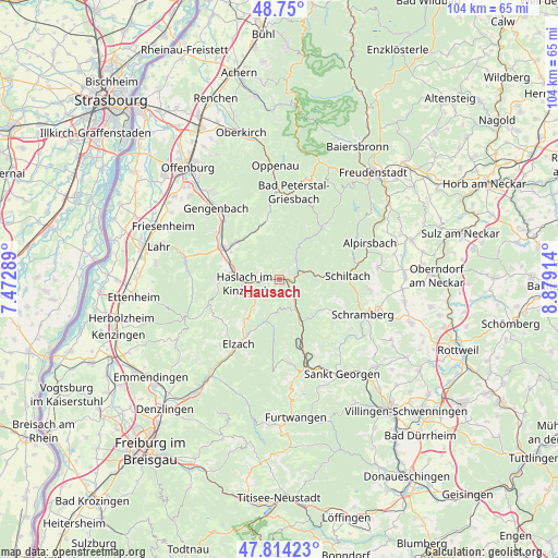
Hausach GPS coordinates[2]
48° 17' 3.336" North, 8° 10' 33.672" East
| Map corner | latitude | longitude |
|---|---|---|
| Upper-left | 48.75°, | 7.47289° |
| Center: | 48.28426°, | 8.17602° |
| Lower-right: | 47.81423°, | 8.87914° |
| Map W x H: | 104×104 km | = 64.6×64.6mi |
| max Lat: | 55.01917° ⇑91.4% North |
| Hausach: | 48.28426° |
| min Lat: | ⇓8.6% South 47.40724° |
| min Long | Hausach | max Long |
| 5.92978° | 8.17602° | 14.98853° |
| W 25.6%⇐ | ⇒74.4% E |
Elevation
Elevation of Hausach is 239 m = 784 ft, and this is 10.1 m = 33 ft below average elevation for this country.
| Max E: |
1256 m = 4121 ft | 48.1% |
| Avg. | 249.1 m = 817 ft | |
| Hausach | 239 m = 784 ft | |
Min E: |
-5 m = -16 ft | 51.9% |
See also: Germany elevation on elevation.city.
Geographical zone
Hausach is located in North temperate zone (between Tropic of Cancer and the Arctic Circle). Distance of this North polar circle is 2032.5 km =1262.9 mi to North.| Distance of | km | miles | from Hausach |
|---|---|---|---|
| North Pole | 4638.4 | 2882.2 | to North |
| Arctic Circle | 2032.5 | 1262.9 | to North |
| Tropic Cancer | 2762.8 | 1716.7 | to South |
| Equator | 5368.7 | 3336 | to South |


Nearby cities:
15 places around Hausach: (largest is in red/bold)
• Biberach
11.9 km =7.4 mi,  297°
297°
• Elzach
14.7 km =9.1 mi,  212°
212°
• Fischerbach
4.9 km =3 mi,  273°
273°
• Gutach
4.8 km =3 mi,  145°
145°
• Hofstetten
8.6 km =5.3 mi,  250°
250°
• Hornberg
9.2 km =5.7 mi, 152°
• Lauterbach/Schwarzwald
13.7 km =8.5 mi,  116°
116°
• Mühlenbach
5.8 km =3.6 mi,  229°
229°
• Nordrach
14.6 km =9.1 mi,  331°
331°
• Oberharmersbach
10.6 km =6.6 mi,  339°
339°
• Oberwolfach
4.7 km =2.9 mi,  39°
39°
• Schenkenzell
14.8 km =9.2 mi,  77°
77°
• Schiltach
12.3 km =7.6 mi,  87°
87°
• Steinach
9.5 km =5.9 mi,  280°
280°
• Wolfach
3.1 km =1.9 mi,  71°
71°
Sources, notices
• [Note1] Compared only with cities in Germany existing in our database
• [Src1] Map data: © OpenStreetMap contributors (CC-BY-SA)
• [Src2] Other city data from geonames.org with taken over terms of usage.
• [Src3] Geographical zone / Annual Mean Temperature by Robert A. Rohde @ Wikipedia
