Heygendorf geodata
Heygendorf (Thuringia) is a seat of a fourth-order administrative division; located in Germany in Europe/Berlin (GMT+2) time zone. With population of 700 people, there are 8312 cities with bigger population in this country. Compared to other cities in Germany, 64% of cities are located further ↓South; 72.1% of cities are located further ←West and 64.7% of cities have higher elevation than Heygendorf. Note1


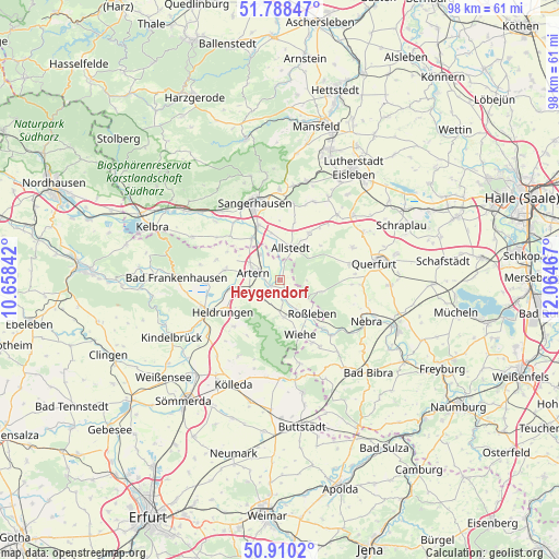
Heygendorf GPS coordinates[2]
51° 21' 5.184" North, 11° 21' 41.544" East
| Map corner | latitude | longitude |
|---|---|---|
| Upper-left | 51.78847°, | 10.65842° |
| Center: | 51.35144°, | 11.36154° |
| Lower-right: | 50.9102°, | 12.06467° |
| Map W x H: | 97.7×97.7 km | = 60.7×60.7mi |
| max Lat: | 55.01917° ⇑36% North |
| Heygendorf: | 51.35144° |
| min Lat: | ⇓64% South 47.40724° |
| min Long | Heygendorf | max Long |
| 5.92978° | 11.36154° | 14.98853° |
| W 72.1%⇐ | ⇒27.9% E |
Elevation
Elevation of Heygendorf is 122 m = 400 ft, and this is 127.1 m = 417 ft below average elevation for this country.
| Max E: |
1256 m = 4121 ft | 64.7% |
| Avg. | 249.1 m = 817 ft | |
| Heygendorf | 122 m = 400 ft | |
Min E: |
-5 m = -16 ft | 35.3% |
See also: Germany elevation on elevation.city.
Geographical zone
Heygendorf is located in North temperate zone (between Tropic of Cancer and the Arctic Circle). Distance of this North polar circle is 1691.4 km =1051 mi to North.| Distance of | km | miles | from Heygendorf |
|---|---|---|---|
| North Pole | 4297.3 | 2670.2 | to North |
| Arctic Circle | 1691.4 | 1051 | to North |
| Tropic Cancer | 3103.8 | 1928.6 | to South |
| Equator | 5709.7 | 3547.8 | to South |


Nearby cities:
15 places around Heygendorf: (largest is in red/bold)
• Allstedt
6.1 km =3.8 mi,  16°
16°
• Artern
5.1 km =3.2 mi,  286°
286°
• Bretleben
9.1 km =5.7 mi,  257°
257°
• Donndorf
6.4 km =4 mi,  172°
172°
• Edersleben
9.1 km =5.7 mi,  323°
323°
• Gehofen
4.3 km =2.7 mi,  222°
222°
• Kalbsrieth
1.8 km =1.1 mi,  235°
235°
• Mönchpfiffel-Nikolausrieth
3.6 km =2.2 mi,  5°
5°
• Nausitz
4.3 km =2.7 mi,  206°
206°
• Reinsdorf
6.9 km =4.3 mi,  253°
253°
• Roßleben
7.7 km =4.8 mi,  139°
139°
• Schönewerda
3.1 km =1.9 mi, 174°
• Voigtstedt
5.8 km =3.6 mi, 320°
• Wolferstedt
9.7 km =6 mi,  31°
31°
• Ziegelroda
7.6 km =4.7 mi,  105°
105°
Sources, notices
• [Note1] Compared only with cities in Germany existing in our database
• [Src1] Map data: © OpenStreetMap contributors (CC-BY-SA)
• [Src2] Other city data from geonames.org with taken over terms of usage.
• [Src3] Geographical zone / Annual Mean Temperature by Robert A. Rohde @ Wikipedia
