Herrnschwende geodata
Herrnschwende (Thuringia) is a seat of a fourth-order administrative division; located in Germany in Europe/Berlin (GMT+2) time zone. With population of 320 people, there are 9983 cities with bigger population in this country. Compared to other cities in Germany, 61.8% of cities are located further ↓South; 66.9% of cities are located further ←West and 60.9% of cities have higher elevation than Herrnschwende. Note1


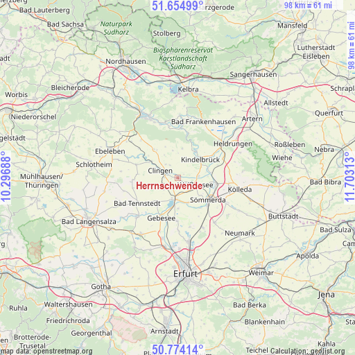
Herrnschwende GPS coordinates[2]
51° 13' 0.012" North, 11° 0' 0" East
| Map corner | latitude | longitude |
|---|---|---|
| Upper-left | 51.65499°, | 10.29688° |
| Center: | 51.21667°, | 11° |
| Lower-right: | 50.77414°, | 11.70313° |
| Map W x H: | 97.9×97.9 km | = 60.8×60.8mi |
| max Lat: | 55.01917° ⇑38.2% North |
| Herrnschwende: | 51.21667° |
| min Lat: | ⇓61.8% South 47.40724° |
| min Long | Herrnschwende | max Long |
| 5.92978° | 11° | 14.98853° |
| W 66.9%⇐ | ⇒33.1% E |
Elevation
Elevation of Herrnschwende is 146 m = 479 ft, and this is 103.1 m = 338 ft below average elevation for this country.
| Max E: |
1256 m = 4121 ft | 60.9% |
| Avg. | 249.1 m = 817 ft | |
| Herrnschwende | 146 m = 479 ft | |
Min E: |
-5 m = -16 ft | 39.1% |
See also: Germany elevation on elevation.city.
Geographical zone
Herrnschwende is located in North temperate zone (between Tropic of Cancer and the Arctic Circle). Distance of this North polar circle is 1706.4 km =1060.3 mi to North.| Distance of | km | miles | from Herrnschwende |
|---|---|---|---|
| North Pole | 4312.3 | 2679.5 | to North |
| Arctic Circle | 1706.4 | 1060.3 | to North |
| Tropic Cancer | 3088.8 | 1919.3 | to South |
| Equator | 5694.8 | 3538.6 | to South |


Nearby cities:
15 places around Herrnschwende: (largest is in red/bold)
• Clingen
5 km =3.1 mi,  290°
290°
• Frömmstedt
5.7 km =3.5 mi,  29°
29°
• Gangloffsömmern
5 km =3.1 mi,  232°
232°
• Greußen
4.1 km =2.5 mi, 290°
• Günstedt
5.6 km =3.5 mi,  84°
84°
• Kindelbrück
8 km =5 mi,  51°
51°
• Niederbösa
5.6 km =3.5 mi,  0°
0°
• Oberbösa
8.2 km =5.1 mi,  8°
8°
• Straußfurt
5.7 km =3.5 mi,  191°
191°
• Topfstedt
6 km =3.7 mi,  337°
337°
• Trebra
7.5 km =4.7 mi,  351°
351°
• Weißensee
5.2 km =3.2 mi,  111°
111°
• Werningshausen
8.6 km =5.3 mi,  179°
179°
• Westgreußen
6.1 km =3.8 mi, 293°
• Wundersleben
7.4 km =4.6 mi,  158°
158°
Sources, notices
• [Note1] Compared only with cities in Germany existing in our database
• [Src1] Map data: © OpenStreetMap contributors (CC-BY-SA)
• [Src2] Other city data from geonames.org with taken over terms of usage.
• [Src3] Geographical zone / Annual Mean Temperature by Robert A. Rohde @ Wikipedia
