Lauterbach/Schwarzwald geodata
Lauterbach/Schwarzwald (Baden-Württemberg) is a seat of a fourth-order administrative division; located in Germany in Europe/Berlin (GMT+2) time zone. With population of 3,193 people, there are 3831 cities with bigger population in this country. Compared to other cities in Germany, 92.2% of cities are located further ↑North; 72.5% of cities are located further →East and 95.7% of cities have lower elevation than Lauterbach/Schwarzwald. Note1
Administrative division(s):
- Level 1: Baden-Württemberg
- Level 2: Freiburg Region
- Level 3: Landkreis Rottweil
- Level 4: Lauterbach/Schwarzwald
Current local time in Lauterbach/Schwarzwald:
02:43 PM, TuesdayDifference from your time zone: hours


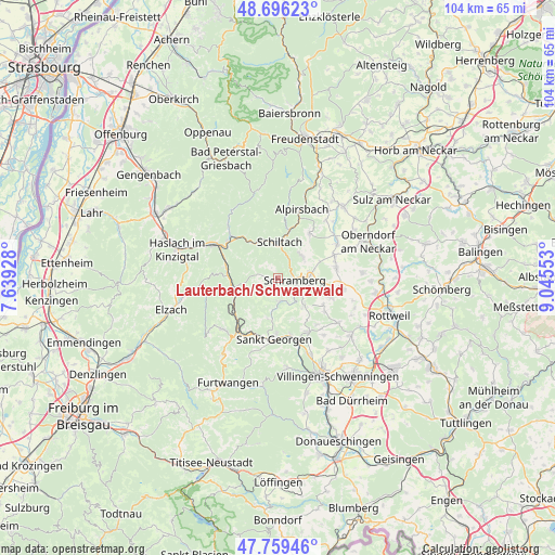
Lauterbach/Schwarzwald GPS coordinates[2]
48° 13' 47.964" North, 8° 20' 32.64" East
| Map corner | latitude | longitude |
|---|---|---|
| Upper-left | 48.69623°, | 7.63928° |
| Center: | 48.22999°, | 8.3424° |
| Lower-right: | 47.75946°, | 9.04553° |
| Map W x H: | 104.2×104.2 km | = 64.7×64.7mi |
| max Lat: | 55.01917° ⇑92.2% North |
| Lauterbach/Schwarzwald: | 48.22999° |
| min Lat: | ⇓7.8% South 47.40724° |
| min Long | Lauterbach/Schw | max Long |
| 5.92978° | 8.3424° | 14.98853° |
| W 27.5%⇐ | ⇒72.5% E |
Elevation
Elevation of Lauterbach/Schwarzwald is 615 m = 2018 ft, and this is 365.9 m = 1200 ft above average elevation for this country.
| Max E: |
1256 m = 4121 ft | 4.3% |
| Lauterbach/Schwarzwald | 615 m 2018 ft | |
| Avg. | 249.1 m = 817 ft | |
Min E: |
-5 m = -16 ft | 95.7% |
See also: Germany elevation on elevation.city.
Geographical zone
Lauterbach/Schwarzwald is located in North temperate zone (between Tropic of Cancer and the Arctic Circle). Distance of this North polar circle is 2038.5 km =1266.7 mi to North.| Distance of | km | miles | from Lauterbach/Schwarzwald |
|---|---|---|---|
| North Pole | 4644.4 | 2885.9 | to North |
| Arctic Circle | 2038.5 | 1266.7 | to North |
| Tropic Cancer | 2756.8 | 1713 | to South |
| Equator | 5362.7 | 3332.2 | to South |


Nearby cities:
15 places around Lauterbach/Schwarzwald: (largest is in red/bold)
• Aichhalden
6.1 km =3.8 mi,  47°
47°
• Alpirsbach
13.5 km =8.4 mi,  19°
19°
• Dunningen
12.3 km =7.6 mi,  99°
99°
• Gutach
9.8 km =6.1 mi,  282°
282°
• Hardt
7.6 km =4.7 mi,  133°
133°
• Hornberg
8.4 km =5.2 mi,  255°
255°
• Königsfeld im Schwarzwald
11.7 km =7.3 mi,  150°
150°
• Oberwolfach
13.4 km =8.3 mi,  316°
316°
• Sankt Georgen im Schwarzwald
11.4 km =7.1 mi,  182°
182°
• Schenkenzell
9.4 km =5.8 mi,  13°
13°
• Schiltach
6.6 km =4.1 mi,  359°
359°
• Schramberg
3.3 km =2.1 mi, 101°
• Seedorf
11.1 km =6.9 mi,  79°
79°
• Tennenbronn
4.5 km =2.8 mi,  171°
171°
• Wolfach
11.7 km =7.3 mi,  306°
306°
Sources, notices
• [Note1] Compared only with cities in Germany existing in our database
• [Src1] Map data: © OpenStreetMap contributors (CC-BY-SA)
• [Src2] Other city data from geonames.org with taken over terms of usage.
• [Src3] Geographical zone / Annual Mean Temperature by Robert A. Rohde @ Wikipedia
