Schiltach geodata
Schiltach (Baden-Württemberg) is a populated place; located in Germany in Europe/Berlin (GMT+2) time zone. With population of 4,025 people, there are 3287 cities with bigger population in this country. Compared to other cities in Germany, 91.4% of cities are located further ↑North; 72.5% of cities are located further →East and 66.8% of cities have lower elevation than Schiltach. Note1
Administrative division(s):
- Level 1: Baden-Württemberg
- Level 2: Freiburg Region
- Level 3: Landkreis Rottweil
- Level 4: Schiltach


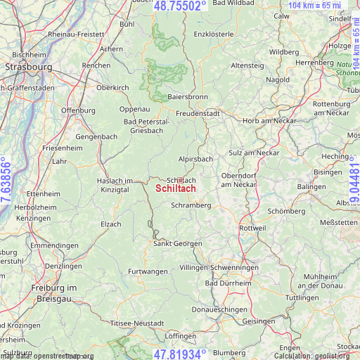
Schiltach GPS coordinates[2]
48° 17' 21.552" North, 8° 20' 30.084" East
| Map corner | latitude | longitude |
|---|---|---|
| Upper-left | 48.75502°, | 7.63856° |
| Center: | 48.28932°, | 8.34169° |
| Lower-right: | 47.81934°, | 9.04481° |
| Map W x H: | 104×104 km | = 64.6×64.6mi |
| max Lat: | 55.01917° ⇑91.4% North |
| Schiltach: | 48.28932° |
| min Lat: | ⇓8.6% South 47.40724° |
| min Long | Schiltach | max Long |
| 5.92978° | 8.34169° | 14.98853° |
| W 27.5%⇐ | ⇒72.5% E |
Elevation
Elevation of Schiltach is 334 m = 1096 ft, and this is 84.9 m = 279 ft above average elevation for this country.
| Max E: |
1256 m = 4121 ft | 33.2% |
| Schiltach | 334 m 1096 ft | |
| Avg. | 249.1 m = 817 ft | |
Min E: |
-5 m = -16 ft | 66.8% |
See also: Germany elevation on elevation.city.
Geographical zone
Schiltach is located in North temperate zone (between Tropic of Cancer and the Arctic Circle). Distance of this North polar circle is 2031.9 km =1262.6 mi to North.| Distance of | km | miles | from Schiltach |
|---|---|---|---|
| North Pole | 4637.8 | 2881.8 | to North |
| Arctic Circle | 2031.9 | 1262.6 | to North |
| Tropic Cancer | 2763.4 | 1717.1 | to South |
| Equator | 5369.3 | 3336.3 | to South |


Nearby cities:
15 places around Schiltach: (largest is in red/bold)
• Aichhalden
5.1 km =3.2 mi,  118°
118°
• Alpirsbach
7.6 km =4.7 mi,  35°
35°
• Dornhan
14.1 km =8.8 mi,  61°
61°
• Gutach
10.6 km =6.6 mi,  244°
244°
• Hardt
13 km =8.1 mi,  154°
154°
• Hausach
12.3 km =7.6 mi,  267°
267°
• Hornberg
11.9 km =7.4 mi,  222°
222°
• Lauterbach/Schwarzwald
6.6 km =4.1 mi,  179°
179°
• Loßburg
14.7 km =9.1 mi,  33°
33°
• Oberwolfach
9.7 km =6 mi,  288°
288°
• Schenkenzell
3.4 km =2.1 mi, 41°
• Schramberg
8 km =5 mi,  155°
155°
• Seedorf
11.8 km =7.3 mi,  112°
112°
• Tennenbronn
11 km =6.8 mi, 176°
• Wolfach
9.3 km =5.8 mi, 272°
Sources, notices
• [Note1] Compared only with cities in Germany existing in our database
• [Src1] Map data: © OpenStreetMap contributors (CC-BY-SA)
• [Src2] Other city data from geonames.org with taken over terms of usage.
• [Src3] Geographical zone / Annual Mean Temperature by Robert A. Rohde @ Wikipedia
