Hasloch geodata
Hasloch (Bavaria) is a seat of a fourth-order administrative division; located in Germany in Europe/Berlin (GMT+2) time zone. With population of 1,414 people, there are 6053 cities with bigger population in this country. Compared to other cities in Germany, 69.2% of cities are located further ↑North; 57.9% of cities are located further →East and 62.2% of cities have higher elevation than Hasloch. Note1
Administrative division(s):
- Level 1: Bavaria
- Level 2: Regierungsbezirk Unterfranken
- Level 3: Landkreis Main-Spessart
- Level 4: Hasloch


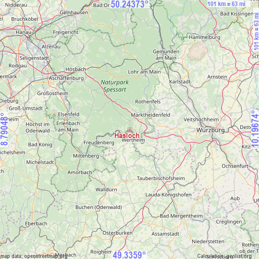
Hasloch GPS coordinates[2]
49° 47' 30.984" North, 9° 29' 36.996" East
| Map corner | latitude | longitude |
|---|---|---|
| Upper-left | 50.24373°, | 8.79048° |
| Center: | 49.79194°, | 9.49361° |
| Lower-right: | 49.3359°, | 10.19674° |
| Map W x H: | 100.9×100.9 km | = 62.7×62.7mi |
| max Lat: | 55.01917° ⇑69.2% North |
| Hasloch: | 49.79194° |
| min Lat: | ⇓30.8% South 47.40724° |
| min Long | Hasloch | max Long |
| 5.92978° | 9.49361° | 14.98853° |
| W 42.1%⇐ | ⇒57.9% E |
Elevation
Elevation of Hasloch is 137 m = 449 ft, and this is 112.1 m = 368 ft below average elevation for this country.
| Max E: |
1256 m = 4121 ft | 62.2% |
| Avg. | 249.1 m = 817 ft | |
| Hasloch | 137 m = 449 ft | |
Min E: |
-5 m = -16 ft | 37.8% |
See also: Germany elevation on elevation.city.
Geographical zone
Hasloch is located in North temperate zone (between Tropic of Cancer and the Arctic Circle). Distance of this North polar circle is 1864.8 km =1158.7 mi to North.| Distance of | km | miles | from Hasloch |
|---|---|---|---|
| North Pole | 4470.7 | 2778 | to North |
| Arctic Circle | 1864.8 | 1158.7 | to North |
| Tropic Cancer | 2930.4 | 1820.9 | to South |
| Equator | 5536.3 | 3440.1 | to South |


Nearby cities:
15 places around Hasloch: (largest is in red/bold)
• Altenbuch
7.8 km =4.8 mi,  301°
301°
• Bischbrunn
8.7 km =5.4 mi,  357°
357°
• Dorfprozelten
8.2 km =5.1 mi,  261°
261°
• Esselbach
7.4 km =4.6 mi,  18°
18°
• Faulbach
3.6 km =2.2 mi, 258°
• Freudenberg
12.7 km =7.9 mi,  250°
250°
• Hafenlohr
11.6 km =7.2 mi,  42°
42°
• Karbach
13.3 km =8.3 mi,  51°
51°
• Kreuzwertheim
3.2 km =2 mi,  146°
146°
• Marktheidenfeld
9.9 km =6.2 mi, 53°
• Neunkirchen
11.5 km =7.1 mi,  214°
214°
• Rothenfels
13.1 km =8.1 mi,  32°
32°
• Schollbrunn
5.2 km =3.2 mi,  335°
335°
• Stadtprozelten
5.9 km =3.7 mi, 262°
• Wertheim
3.8 km =2.4 mi,  163°
163°
Sources, notices
• [Note1] Compared only with cities in Germany existing in our database
• [Src1] Map data: © OpenStreetMap contributors (CC-BY-SA)
• [Src2] Other city data from geonames.org with taken over terms of usage.
• [Src3] Geographical zone / Annual Mean Temperature by Robert A. Rohde @ Wikipedia
