Haar geodata
Haar (Bavaria) is a populated place; located in Germany in Europe/Berlin (GMT+2) time zone. With population of 17,560 people, there are 907 cities with bigger population in this country. Compared to other cities in Germany, 93.9% of cities are located further ↑North; 77.6% of cities are located further ←West and 92.2% of cities have lower elevation than Haar. Note1
Administrative division(s):
- Level 1: Bavaria
- Level 2: Upper Bavaria
- Level 3: Landkreis München
- Level 4: Haar


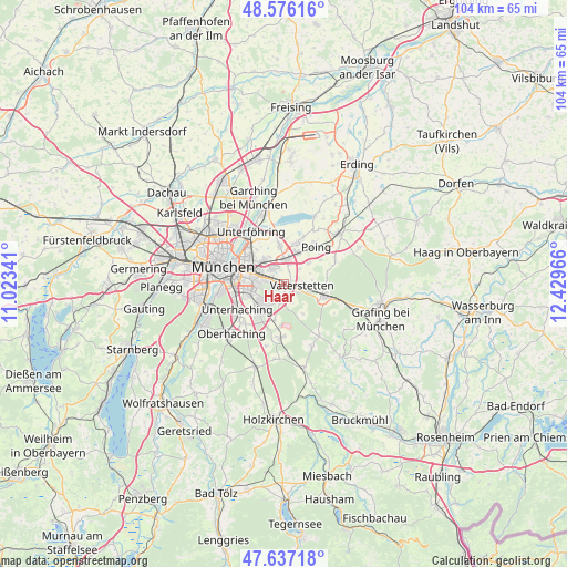
Haar GPS coordinates[2]
48° 6' 31.716" North, 11° 43' 35.508" East
| Map corner | latitude | longitude |
|---|---|---|
| Upper-left | 48.57616°, | 11.02341° |
| Center: | 48.10881°, | 11.72653° |
| Lower-right: | 47.63718°, | 12.42966° |
| Map W x H: | 104.4×104.4 km | = 64.9×64.9mi |
| max Lat: | 55.01917° ⇑93.9% North |
| Haar: | 48.10881° |
| min Lat: | ⇓6.1% South 47.40724° |
| min Long | Haar | max Long |
| 5.92978° | 11.72653° | 14.98853° |
| W 77.6%⇐ | ⇒22.4% E |
Elevation
Elevation of Haar is 545 m = 1788 ft, and this is 295.9 m = 971 ft above average elevation for this country.
| Max E: |
1256 m = 4121 ft | 7.8% |
| Haar | 545 m 1788 ft | |
| Avg. | 249.1 m = 817 ft | |
Min E: |
-5 m = -16 ft | 92.2% |
See also: Germany elevation on elevation.city.
Geographical zone
Haar is located in North temperate zone (between Tropic of Cancer and the Arctic Circle). Distance of this North polar circle is 2052 km =1275.1 mi to North.| Distance of | km | miles | from Haar |
|---|---|---|---|
| North Pole | 4657.9 | 2894.3 | to North |
| Arctic Circle | 2052 | 1275.1 | to North |
| Tropic Cancer | 2743.3 | 1704.6 | to South |
| Equator | 5349.2 | 3323.8 | to South |


Nearby cities:
15 places around Haar: (largest is in red/bold)
• Anzing
10.5 km =6.5 mi,  63°
63°
• Aschheim
7 km =4.3 mi,  354°
354°
• Bogenhausen
9.5 km =5.9 mi,  300°
300°
• Feldkirchen
4.4 km =2.7 mi,  4°
4°
• Grasbrunn
3.5 km =2.2 mi,  159°
159°
• Hohenbrunn
7 km =4.3 mi,  194°
194°
• Höhenkirchen-Siegertsbrunn
10 km =6.2 mi,  183°
183°
• Kirchheim bei München
7.8 km =4.8 mi,  15°
15°
• Neubiberg
6.2 km =3.9 mi,  235°
235°
• Ottobrunn
6.8 km =4.2 mi,  223°
223°
• Poing
9.6 km =6 mi,  45°
45°
• Putzbrunn
3.8 km =2.4 mi, 192°
• Unterhaching
9.5 km =5.9 mi, 239°
• Vaterstetten
3.1 km =1.9 mi,  97°
97°
• Zorneding
7.8 km =4.8 mi,  110°
110°
Sources, notices
• [Note1] Compared only with cities in Germany existing in our database
• [Src1] Map data: © OpenStreetMap contributors (CC-BY-SA)
• [Src2] Other city data from geonames.org with taken over terms of usage.
• [Src3] Geographical zone / Annual Mean Temperature by Robert A. Rohde @ Wikipedia
