Zorneding geodata
Zorneding (Bavaria) is a seat of a fourth-order administrative division; located in Germany in Europe/Berlin (GMT+2) time zone. With population of 8,581 people, there are 1865 cities with bigger population in this country. Compared to other cities in Germany, 94.3% of cities are located further ↑North; 79.2% of cities are located further ←West and 93.3% of cities have lower elevation than Zorneding. Note1
Administrative division(s):
- Level 1: Bavaria
- Level 2: Upper Bavaria
- Level 3: Landkreis Ebersberg
- Level 4: Zorneding


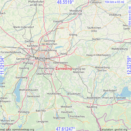
Zorneding GPS coordinates[2]
48° 5' 3.588" North, 11° 49' 28.056" East
| Map corner | latitude | longitude |
|---|---|---|
| Upper-left | 48.5519°, | 11.12134° |
| Center: | 48.08433°, | 11.82446° |
| Lower-right: | 47.61247°, | 12.52759° |
| Map W x H: | 104.5×104.5 km | = 64.9×64.9mi |
| max Lat: | 55.01917° ⇑94.3% North |
| Zorneding: | 48.08433° |
| min Lat: | ⇓5.7% South 47.40724° |
| min Long | Zorneding | max Long |
| 5.92978° | 11.82446° | 14.98853° |
| W 79.2%⇐ | ⇒20.8% E |
Elevation
Elevation of Zorneding is 563 m = 1847 ft, and this is 313.9 m = 1030 ft above average elevation for this country.
| Max E: |
1256 m = 4121 ft | 6.7% |
| Zorneding | 563 m 1847 ft | |
| Avg. | 249.1 m = 817 ft | |
Min E: |
-5 m = -16 ft | 93.3% |
See also: Germany elevation on elevation.city.
Geographical zone
Zorneding is located in North temperate zone (between Tropic of Cancer and the Arctic Circle). Distance of this North polar circle is 2054.7 km =1276.7 mi to North.| Distance of | km | miles | from Zorneding |
|---|---|---|---|
| North Pole | 4660.6 | 2896 | to North |
| Arctic Circle | 2054.7 | 1276.7 | to North |
| Tropic Cancer | 2740.6 | 1702.9 | to South |
| Equator | 5346.5 | 3322.2 | to South |


Nearby cities:
15 places around Zorneding: (largest is in red/bold)
• Anzing
7.8 km =4.8 mi,  15°
15°
• Bruck
9.4 km =5.8 mi,  138°
138°
• Ebersberg
10.9 km =6.8 mi,  94°
94°
• Egmating
9.2 km =5.7 mi,  193°
193°
• Feldkirchen
9.9 km =6.2 mi,  315°
315°
• Grasbrunn
6 km =3.7 mi,  264°
264°
• Haar
7.8 km =4.8 mi,  290°
290°
• Hohenbrunn
9.9 km =6.2 mi,  245°
245°
• Höhenkirchen-Siegertsbrunn
10.7 km =6.6 mi,  227°
227°
• Kirchseeon
5 km =3.1 mi,  106°
106°
• Moosach
6.9 km =4.3 mi,  147°
147°
• Oberpframmern
7 km =4.3 mi, 186°
• Poing
9.5 km =5.9 mi,  357°
357°
• Putzbrunn
8.1 km =5 mi, 263°
• Vaterstetten
4.8 km =3 mi,  299°
299°
Sources, notices
• [Note1] Compared only with cities in Germany existing in our database
• [Src1] Map data: © OpenStreetMap contributors (CC-BY-SA)
• [Src2] Other city data from geonames.org with taken over terms of usage.
• [Src3] Geographical zone / Annual Mean Temperature by Robert A. Rohde @ Wikipedia
