Grasbrunn geodata
Grasbrunn (Bavaria) is a seat of a fourth-order administrative division; located in Germany in Europe/Berlin (GMT+2) time zone. With population of 5,737 people, there are 2549 cities with bigger population in this country. Compared to other cities in Germany, 94.3% of cities are located further ↑North; 77.9% of cities are located further ←West and 92.8% of cities have lower elevation than Grasbrunn. Note1
Administrative division(s):
- Level 1: Bavaria
- Level 2: Upper Bavaria
- Level 3: Landkreis München
- Level 4: Grasbrunn


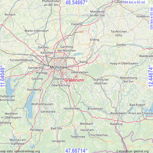
Grasbrunn GPS coordinates[2]
48° 4' 44.58" North, 11° 44' 36.996" East
| Map corner | latitude | longitude |
|---|---|---|
| Upper-left | 48.54667°, | 11.04049° |
| Center: | 48.07905°, | 11.74361° |
| Lower-right: | 47.60714°, | 12.44674° |
| Map W x H: | 104.5×104.5 km | = 64.9×64.9mi |
| max Lat: | 55.01917° ⇑94.3% North |
| Grasbrunn: | 48.07905° |
| min Lat: | ⇓5.7% South 47.40724° |
| min Long | Grasbrunn | max Long |
| 5.92978° | 11.74361° | 14.98853° |
| W 77.9%⇐ | ⇒22.1% E |
Elevation
Elevation of Grasbrunn is 555 m = 1821 ft, and this is 305.9 m = 1004 ft above average elevation for this country.
| Max E: |
1256 m = 4121 ft | 7.2% |
| Grasbrunn | 555 m 1821 ft | |
| Avg. | 249.1 m = 817 ft | |
Min E: |
-5 m = -16 ft | 92.8% |
See also: Germany elevation on elevation.city.
Geographical zone
Grasbrunn is located in North temperate zone (between Tropic of Cancer and the Arctic Circle). Distance of this North polar circle is 2055.3 km =1277.1 mi to North.| Distance of | km | miles | from Grasbrunn |
|---|---|---|---|
| North Pole | 4661.2 | 2896.3 | to North |
| Arctic Circle | 2055.3 | 1277.1 | to North |
| Tropic Cancer | 2740 | 1702.6 | to South |
| Equator | 5345.9 | 3321.8 | to South |


Nearby cities:
15 places around Grasbrunn: (largest is in red/bold)
• Aschheim
10.4 km =6.5 mi,  348°
348°
• Brunnthal
9.2 km =5.7 mi,  208°
208°
• Egmating
9.2 km =5.7 mi,  155°
155°
• Feldkirchen
7.7 km =4.8 mi, 353°
• Haar
3.5 km =2.2 mi,  339°
339°
• Hohenbrunn
4.6 km =2.9 mi,  221°
221°
• Höhenkirchen-Siegertsbrunn
6.9 km =4.3 mi,  195°
195°
• Neubiberg
6.4 km =4 mi,  268°
268°
• Oberpframmern
8.2 km =5.1 mi,  140°
140°
• Ottobrunn
6.2 km =3.9 mi,  255°
255°
• Putzbrunn
2.1 km =1.3 mi, 260°
• Taufkirchen
10 km =6.2 mi,  250°
250°
• Unterhaching
9.6 km =6 mi, 261°
• Vaterstetten
3.5 km =2.2 mi,  32°
32°
• Zorneding
6 km =3.7 mi,  84°
84°
Sources, notices
• [Note1] Compared only with cities in Germany existing in our database
• [Src1] Map data: © OpenStreetMap contributors (CC-BY-SA)
• [Src2] Other city data from geonames.org with taken over terms of usage.
• [Src3] Geographical zone / Annual Mean Temperature by Robert A. Rohde @ Wikipedia
