Gumtow geodata
Gumtow (Brandenburg) is a seat of a fourth-order administrative division; located in Germany in Europe/Berlin (GMT+2) time zone. With population of 4,093 people, there are 3239 cities with bigger population in this country. Compared to other cities in Germany, 81.6% of cities are located further ↓South; 85.2% of cities are located further ←West and 76.4% of cities have higher elevation than Gumtow. Note1


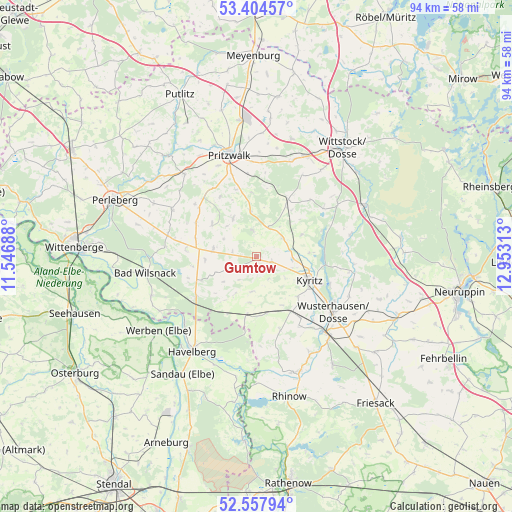
Gumtow GPS coordinates[2]
52° 58' 59.988" North, 12° 15' 0" East
| Map corner | latitude | longitude |
|---|---|---|
| Upper-left | 53.40457°, | 11.54688° |
| Center: | 52.98333°, | 12.25° |
| Lower-right: | 52.55794°, | 12.95313° |
| Map W x H: | 94.1×94.1 km | = 58.5×58.5mi |
| max Lat: | 55.01917° ⇑18.4% North |
| Gumtow: | 52.98333° |
| min Lat: | ⇓81.6% South 47.40724° |
| min Long | Gumtow | max Long |
| 5.92978° | 12.25° | 14.98853° |
| W 85.2%⇐ | ⇒14.8% E |
Elevation
Elevation of Gumtow is 58 m = 190 ft, and this is 191.1 m = 627 ft below average elevation for this country.
| Max E: |
1256 m = 4121 ft | 76.4% |
| Avg. | 249.1 m = 817 ft | |
| Gumtow | 58 m = 190 ft | |
Min E: |
-5 m = -16 ft | 23.6% |
See also: Germany elevation on elevation.city.
Geographical zone
Gumtow is located in North temperate zone (between Tropic of Cancer and the Arctic Circle). Distance of this North polar circle is 1510 km =938.3 mi to North.| Distance of | km | miles | from Gumtow |
|---|---|---|---|
| North Pole | 4115.9 | 2557.5 | to North |
| Arctic Circle | 1510 | 938.3 | to North |
| Tropic Cancer | 3285.3 | 2041.4 | to South |
| Equator | 5891.2 | 3660.6 | to South |


Nearby cities:
15 places around Gumtow: (largest is in red/bold)
• Bad Wilsnack
20.4 km =12.7 mi,  261°
261°
• Breddin
11 km =6.8 mi,  189°
189°
• Dreetz
24.5 km =15.2 mi,  144°
144°
• Groß Pankow
20.2 km =12.6 mi,  318°
318°
• Großderschau
22.9 km =14.2 mi,  159°
159°
• Havelberg
20.6 km =12.8 mi,  214°
214°
• Heiligengrabe
19.4 km =12.1 mi,  22°
22°
• Kyritz
10.9 km =6.8 mi,  114°
114°
• Legde
20.5 km =12.7 mi,  249°
249°
• Plattenburg
15 km =9.3 mi, 259°
• Pritzwalk
19.2 km =11.9 mi,  344°
344°
• Sandau
25.5 km =15.8 mi, 212°
• Werben
22.5 km =14 mi,  232°
232°
• Wittstock
25.2 km =15.7 mi,  38°
38°
• Wusterhausen
17.4 km =10.8 mi,  126°
126°
Sources, notices
• [Note1] Compared only with cities in Germany existing in our database
• [Src1] Map data: © OpenStreetMap contributors (CC-BY-SA)
• [Src2] Other city data from geonames.org with taken over terms of usage.
• [Src3] Geographical zone / Annual Mean Temperature by Robert A. Rohde @ Wikipedia
