Grossenbrode geodata
Grossenbrode (Schleswig-Holstein) is a populated place; located in Germany in Europe/Berlin (GMT+2) time zone. With population of 2,190 people, there are 4818 cities with bigger population in this country. Compared to other cities in Germany, 97.2% of cities are located further ↓South; 68.1% of cities are located further ←West and 99.9% of cities have higher elevation than Grossenbrode. Note1
Administrative division(s):
- Level 1: Schleswig-Holstein
- Level 3: Kreis Ostholstein
- Level 4: Großenbrode


Grossenbrode GPS coordinates[2]
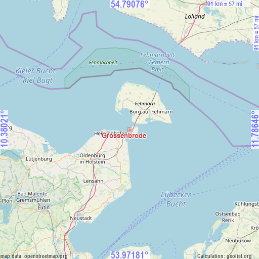
54° 22' 59.988" North, 11° 4' 59.988" East
| Map corner | latitude | longitude |
|---|---|---|
| Upper-left | 54.79076°, | 10.38021° |
| Center: | 54.38333°, | 11.08333° |
| Lower-right: | 53.97181°, | 11.78646° |
| Map W x H: | 91.1×91.1 km | = 56.6×56.6mi |
| max Lat: | 55.01917° ⇑2.8% North |
| Grossenbrode: | 54.38333° |
| min Lat: | ⇓97.2% South 47.40724° |
| min Long | Grossenbrode | max Long |
| 5.92978° | 11.08333° | 14.98853° |
| W 68.1%⇐ | ⇒31.9% E |
Elevation
Elevation of Grossenbrode is -3 m = -10 ft, and this is 252.1 m = 827 ft below average elevation for this country.
| Max E: |
1256 m = 4121 ft | 99.9% |
| Avg. | 249.1 m = 817 ft | |
| Grossenbrode | -3 m = -10 ft | |
Min E: |
-5 m = -16 ft | 0.1% |
See also: Germany elevation on elevation.city.
Geographical zone
Grossenbrode is located in North temperate zone (between Tropic of Cancer and the Arctic Circle). Distance of this North polar circle is 1354.3 km =841.5 mi to North.| Distance of | km | miles | from Grossenbrode |
|---|---|---|---|
| North Pole | 3960.2 | 2460.8 | to North |
| Arctic Circle | 1354.3 | 841.5 | to North |
| Tropic Cancer | 3440.9 | 2138.1 | to South |
| Equator | 6046.9 | 3757.4 | to South |


Nearby cities:
15 places around Grossenbrode: (largest is in red/bold)
• Burg auf Fehmarn
9.4 km =5.8 mi,  53°
53°
• Dahme
18.5 km =11.5 mi,  180°
180°
• Damlos
19 km =11.8 mi,  218°
218°
• Fehmarn
9.4 km =5.8 mi, 49°
• Goel
14.5 km =9 mi, 219°
• Gremersdorf
11.2 km =7 mi,  240°
240°
• Grube
17 km =10.6 mi,  191°
191°
• Heiligenhafen
6.8 km =4.2 mi,  257°
257°
• Heringsdorf
10.4 km =6.5 mi,  208°
208°
• Kabelhorst
21.5 km =13.4 mi, 210°
• Kellenhusen
21.2 km =13.2 mi, 183°
• Lensahn
22.6 km =14 mi, 214°
• Neukirchen
8 km =5 mi, 214°
• Oldenburg in Holstein
15.3 km =9.5 mi,  230°
230°
• Riepsdorf
18.9 km =11.7 mi,  202°
202°
Sources, notices
• [Note1] Compared only with cities in Germany existing in our database
• [Src1] Map data: © OpenStreetMap contributors (CC-BY-SA)
• [Src2] Other city data from geonames.org with taken over terms of usage.
• [Src3] Geographical zone / Annual Mean Temperature by Robert A. Rohde @ Wikipedia
