Großbardorf geodata
Großbardorf (Bavaria) is a seat of a fourth-order administrative division; located in Germany in Europe/Berlin (GMT+2) time zone. With population of 1,006 people, there are 7161 cities with bigger population in this country. Compared to other cities in Germany, 57.5% of cities are located further ↑North; 56.6% of cities are located further ←West and 59.8% of cities have lower elevation than Großbardorf. Note1
Administrative division(s):
- Level 1: Bavaria
- Level 2: Regierungsbezirk Unterfranken
- Level 3: Landkreis Rhön-Grabfeld
- Level 4: Großbardorf


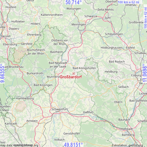
Großbardorf GPS coordinates[2]
50° 16' 0.012" North, 10° 22' 0.012" East
| Map corner | latitude | longitude |
|---|---|---|
| Upper-left | 50.714°, | 9.66355° |
| Center: | 50.26667°, | 10.36667° |
| Lower-right: | 49.8151°, | 11.0698° |
| Map W x H: | 99.9×99.9 km | = 62.1×62.1mi |
| max Lat: | 55.01917° ⇑57.5% North |
| Großbardorf: | 50.26667° |
| min Lat: | ⇓42.5% South 47.40724° |
| min Long | Großbardorf | max Long |
| 5.92978° | 10.36667° | 14.98853° |
| W 56.6%⇐ | ⇒43.4% E |
Elevation
Elevation of Großbardorf is 289 m = 948 ft, and this is 39.9 m = 131 ft above average elevation for this country.
| Max E: |
1256 m = 4121 ft | 40.2% |
| Großbardorf | 289 m 948 ft | |
| Avg. | 249.1 m = 817 ft | |
Min E: |
-5 m = -16 ft | 59.8% |
See also: Germany elevation on elevation.city.
Geographical zone
Großbardorf is located in North temperate zone (between Tropic of Cancer and the Arctic Circle). Distance of this North polar circle is 1812 km =1125.9 mi to North.| Distance of | km | miles | from Großbardorf |
|---|---|---|---|
| North Pole | 4417.9 | 2745.2 | to North |
| Arctic Circle | 1812 | 1125.9 | to North |
| Tropic Cancer | 2983.2 | 1853.7 | to South |
| Equator | 5589.1 | 3472.9 | to South |


Nearby cities:
15 places around Großbardorf: (largest is in red/bold)
• Aubstadt
8.8 km =5.5 mi,  32°
32°
• Bad Königshofen im Grabfeld
8.2 km =5.1 mi,  62°
62°
• Großeibstadt
4.9 km =3 mi,  38°
38°
• Herbstadt
12 km =7.5 mi,  51°
51°
• Hollstadt
10.4 km =6.5 mi,  332°
332°
• Maßbach
11.3 km =7 mi,  215°
215°
• Münnerstadt
11.9 km =7.4 mi,  259°
259°
• Rödelmaier
8.7 km =5.4 mi,  312°
312°
• Saal an der Saale
5.6 km =3.5 mi,  353°
353°
• Salz
11.9 km =7.4 mi,  292°
292°
• Stadtlauringen
8.9 km =5.5 mi,  182°
182°
• Strahlungen
9.7 km =6 mi,  281°
281°
• Sulzfeld
2.8 km =1.7 mi,  105°
105°
• Thundorf in Unterfranken
8.1 km =5 mi,  204°
204°
• Wülfershausen
7.5 km =4.7 mi, 345°
Sources, notices
• [Note1] Compared only with cities in Germany existing in our database
• [Src1] Map data: © OpenStreetMap contributors (CC-BY-SA)
• [Src2] Other city data from geonames.org with taken over terms of usage.
• [Src3] Geographical zone / Annual Mean Temperature by Robert A. Rohde @ Wikipedia
