Münnerstadt geodata
Münnerstadt (Bavaria) is a populated place; located in Germany in Europe/Berlin (GMT+2) time zone. With population of 7,987 people, there are 1957 cities with bigger population in this country. Compared to other cities in Germany, 58% of cities are located further ↑North; 53.4% of cities are located further ←West and 53.2% of cities have lower elevation than Münnerstadt. Note1
Administrative division(s):
- Level 1: Bavaria
- Level 2: Regierungsbezirk Unterfranken
- Level 3: Landkreis Bad Kissingen
- Level 4: Münnerstadt


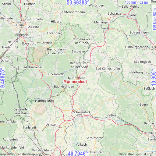
Münnerstadt GPS coordinates[2]
50° 14' 46.896" North, 10° 12' 6.732" East
| Map corner | latitude | longitude |
|---|---|---|
| Upper-left | 50.69388°, | 9.49875° |
| Center: | 50.24636°, | 10.20187° |
| Lower-right: | 49.7946°, | 10.905° |
| Map W x H: | 100×100 km | = 62.1×62.1mi |
| max Lat: | 55.01917° ⇑58% North |
| Münnerstadt: | 50.24636° |
| min Lat: | ⇓42% South 47.40724° |
| min Long | Münnerstadt | max Long |
| 5.92978° | 10.20187° | 14.98853° |
| W 53.4%⇐ | ⇒46.6% E |
Elevation
Elevation of Münnerstadt is 248 m = 814 ft, and this is 1.1 m = 4 ft below average elevation for this country.
| Max E: |
1256 m = 4121 ft | 46.8% |
| Avg. | 249.1 m = 817 ft | |
| Münnerstadt | 248 m = 814 ft | |
Min E: |
-5 m = -16 ft | 53.2% |
See also: Germany elevation on elevation.city.
Geographical zone
Münnerstadt is located in North temperate zone (between Tropic of Cancer and the Arctic Circle). Distance of this North polar circle is 1814.3 km =1127.4 mi to North.| Distance of | km | miles | from Münnerstadt |
|---|---|---|---|
| North Pole | 4420.2 | 2746.6 | to North |
| Arctic Circle | 1814.3 | 1127.4 | to North |
| Tropic Cancer | 2981 | 1852.3 | to South |
| Equator | 5586.9 | 3471.5 | to South |


Nearby cities:
15 places around Münnerstadt: (largest is in red/bold)
• Bad Bocklet
9 km =5.6 mi,  284°
284°
• Bad Kissingen
10.1 km =6.3 mi,  240°
240°
• Bad Neustadt an der Saale
8.4 km =5.2 mi,  2°
2°
• Burglauer
3.7 km =2.3 mi,  334°
334°
• Großbardorf
11.9 km =7.4 mi,  79°
79°
• Hohenroth
7.9 km =4.9 mi,  350°
350°
• Maßbach
8.7 km =5.4 mi,  143°
143°
• Niederlauer
5.6 km =3.5 mi,  341°
341°
• Nüdlingen
6.3 km =3.9 mi, 242°
• Oerlenbach
11.8 km =7.3 mi,  204°
204°
• Rannungen
9 km =5.6 mi,  178°
178°
• Rödelmaier
9.8 km =6.1 mi,  33°
33°
• Salz
6.9 km =4.3 mi,  5°
5°
• Strahlungen
4.7 km =2.9 mi, 28°
• Thundorf in Unterfranken
9.7 km =6 mi,  121°
121°
Sources, notices
• [Note1] Compared only with cities in Germany existing in our database
• [Src1] Map data: © OpenStreetMap contributors (CC-BY-SA)
• [Src2] Other city data from geonames.org with taken over terms of usage.
• [Src3] Geographical zone / Annual Mean Temperature by Robert A. Rohde @ Wikipedia
