Grebenstein geodata
Grebenstein (Hesse) is a populated place; located in Germany in Europe/Berlin (GMT+2) time zone. With population of 6,238 people, there are 2388 cities with bigger population in this country. Compared to other cities in Germany, 65.5% of cities are located further ↓South; 59.1% of cities are located further →East and 53.7% of cities have higher elevation than Grebenstein. Note1
Administrative division(s):
- Level 1: Hesse
- Level 2: Regierungsbezirk Kassel
- Level 3: Landkreis Kassel
- Level 4: Grebenstein


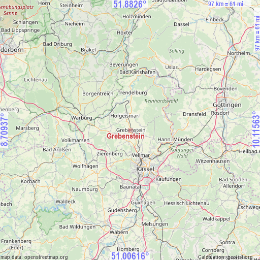
Grebenstein GPS coordinates[2]
51° 26' 47.328" North, 9° 24' 45" East
| Map corner | latitude | longitude |
|---|---|---|
| Upper-left | 51.8826°, | 8.70937° |
| Center: | 51.44648°, | 9.4125° |
| Lower-right: | 51.00616°, | 10.11563° |
| Map W x H: | 97.5×97.5 km | = 60.6×60.6mi |
| max Lat: | 55.01917° ⇑34.5% North |
| Grebenstein: | 51.44648° |
| min Lat: | ⇓65.5% South 47.40724° |
| min Long | Grebenstein | max Long |
| 5.92978° | 9.4125° | 14.98853° |
| W 40.9%⇐ | ⇒59.1% E |
Elevation
Elevation of Grebenstein is 199 m = 653 ft, and this is 50.1 m = 164 ft below average elevation for this country.
| Max E: |
1256 m = 4121 ft | 53.7% |
| Avg. | 249.1 m = 817 ft | |
| Grebenstein | 199 m = 653 ft | |
Min E: |
-5 m = -16 ft | 46.3% |
See also: Germany elevation on elevation.city.
Geographical zone
Grebenstein is located in North temperate zone (between Tropic of Cancer and the Arctic Circle). Distance of this North polar circle is 1680.9 km =1044.5 mi to North.| Distance of | km | miles | from Grebenstein |
|---|---|---|---|
| North Pole | 4286.7 | 2663.6 | to North |
| Arctic Circle | 1680.9 | 1044.5 | to North |
| Tropic Cancer | 3114.4 | 1935.2 | to South |
| Equator | 5720.3 | 3554.4 | to South |


Nearby cities:
15 places around Grebenstein: (largest is in red/bold)
• Borgentreich
18.1 km =11.2 mi,  318°
318°
• Breuna
16.1 km =10 mi,  257°
257°
• Calden
4.2 km =2.6 mi,  190°
190°
• Espenau
6.8 km =4.2 mi,  144°
144°
• Fuldatal
12.8 km =8 mi,  123°
123°
• Hannoversch Münden
16.9 km =10.5 mi,  101°
101°
• Hofgeismar
5.8 km =3.6 mi,  340°
340°
• Immenhausen
5.1 km =3.2 mi,  114°
114°
• Kassel
15.7 km =9.8 mi,  157°
157°
• Liebenau
10.6 km =6.6 mi,  301°
301°
• Trendelburg
14.2 km =8.8 mi,  2°
2°
• Udenhausen
4 km =2.5 mi,  61°
61°
• Vellmar
10.9 km =6.8 mi,  154°
154°
• Warburg
19.1 km =11.9 mi,  284°
284°
• Zierenberg
11.5 km =7.1 mi,  221°
221°
Sources, notices
• [Note1] Compared only with cities in Germany existing in our database
• [Src1] Map data: © OpenStreetMap contributors (CC-BY-SA)
• [Src2] Other city data from geonames.org with taken over terms of usage.
• [Src3] Geographical zone / Annual Mean Temperature by Robert A. Rohde @ Wikipedia
