Borgentreich geodata
Borgentreich (North Rhine-Westphalia) is a populated place; located in Germany in Europe/Berlin (GMT+2) time zone. With population of 9,713 people, there are 1669 cities with bigger population in this country. Compared to other cities in Germany, 67.1% of cities are located further ↓South; 61.6% of cities are located further →East and 52.9% of cities have higher elevation than Borgentreich. Note1
Administrative division(s):
- Level 1: North Rhine-Westphalia
- Level 2: Regierungsbezirk Detmold
- Level 3: Kreis Höxter
- Level 4: Borgentreich


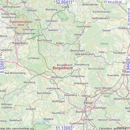
Borgentreich GPS coordinates[2]
51° 34' 9.012" North, 9° 14' 28.068" East
| Map corner | latitude | longitude |
|---|---|---|
| Upper-left | 52.00411°, | 8.53801° |
| Center: | 51.56917°, | 9.24113° |
| Lower-right: | 51.13003°, | 9.94426° |
| Map W x H: | 97.2×97.2 km | = 60.4×60.4mi |
| max Lat: | 55.01917° ⇑32.9% North |
| Borgentreich: | 51.56917° |
| min Lat: | ⇓67.1% South 47.40724° |
| min Long | Borgentreich | max Long |
| 5.92978° | 9.24113° | 14.98853° |
| W 38.4%⇐ | ⇒61.6% E |
Elevation
Elevation of Borgentreich is 205 m = 673 ft, and this is 44.1 m = 145 ft below average elevation for this country.
| Max E: |
1256 m = 4121 ft | 52.9% |
| Avg. | 249.1 m = 817 ft | |
| Borgentreich | 205 m = 673 ft | |
Min E: |
-5 m = -16 ft | 47.1% |
See also: Germany elevation on elevation.city.
Geographical zone
Borgentreich is located in North temperate zone (between Tropic of Cancer and the Arctic Circle). Distance of this North polar circle is 1667.2 km =1035.9 mi to North.| Distance of | km | miles | from Borgentreich |
|---|---|---|---|
| North Pole | 4273.1 | 2655.2 | to North |
| Arctic Circle | 1667.2 | 1035.9 | to North |
| Tropic Cancer | 3128 | 1943.6 | to South |
| Equator | 5734 | 3562.9 | to South |


Nearby cities:
15 places around Borgentreich: (largest is in red/bold)
• Bad Karlshafen
16.9 km =10.5 mi,  61°
61°
• Beverungen
14.3 km =8.9 mi,  39°
39°
• Brakel
16.9 km =10.5 mi,  347°
347°
• Breuna
17.5 km =10.9 mi,  192°
192°
• Calden
21 km =13 mi,  147°
147°
• Derental
19.2 km =11.9 mi, 43°
• Grebenstein
18.1 km =11.2 mi,  138°
138°
• Hofgeismar
12.8 km =8 mi,  129°
129°
• Liebenau
8.5 km =5.3 mi,  160°
160°
• Rhoden
19.2 km =11.9 mi,  236°
236°
• Trendelburg
12.4 km =7.7 mi,  87°
87°
• Udenhausen
19.3 km =12 mi, 127°
• Volkmarsen
19.7 km =12.2 mi,  205°
205°
• Warburg
11 km =6.8 mi,  216°
216°
• Willebadessen
15.4 km =9.6 mi,  293°
293°
Sources, notices
• [Note1] Compared only with cities in Germany existing in our database
• [Src1] Map data: © OpenStreetMap contributors (CC-BY-SA)
• [Src2] Other city data from geonames.org with taken over terms of usage.
• [Src3] Geographical zone / Annual Mean Temperature by Robert A. Rohde @ Wikipedia
