Egmating geodata
Egmating (Bavaria) is a seat of a fourth-order administrative division; located in Germany in Europe/Berlin (GMT+2) time zone. With population of 2,008 people, there are 5058 cities with bigger population in this country. Compared to other cities in Germany, 95.5% of cities are located further ↑North; 78.7% of cities are located further ←West and 95.6% of cities have lower elevation than Egmating. Note1
Administrative division(s):
- Level 1: Bavaria
- Level 2: Upper Bavaria
- Level 3: Landkreis Ebersberg
- Level 4: Egmating


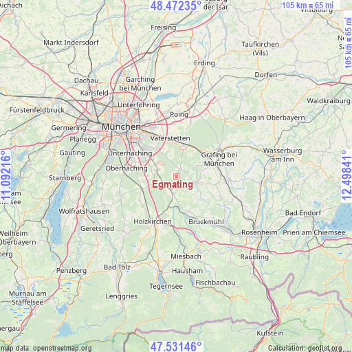
Egmating GPS coordinates[2]
48° 0' 14.58" North, 11° 47' 43.008" East
| Map corner | latitude | longitude |
|---|---|---|
| Upper-left | 48.47235°, | 11.09216° |
| Center: | 48.00405°, | 11.79528° |
| Lower-right: | 47.53146°, | 12.49841° |
| Map W x H: | 104.6×104.6 km | = 65×65mi |
| max Lat: | 55.01917° ⇑95.5% North |
| Egmating: | 48.00405° |
| min Lat: | ⇓4.5% South 47.40724° |
| min Long | Egmating | max Long |
| 5.92978° | 11.79528° | 14.98853° |
| W 78.7%⇐ | ⇒21.3% E |
Elevation
Elevation of Egmating is 612 m = 2008 ft, and this is 362.9 m = 1191 ft above average elevation for this country.
| Max E: |
1256 m = 4121 ft | 4.4% |
| Egmating | 612 m 2008 ft | |
| Avg. | 249.1 m = 817 ft | |
Min E: |
-5 m = -16 ft | 95.6% |
See also: Germany elevation on elevation.city.
Geographical zone
Egmating is located in North temperate zone (between Tropic of Cancer and the Arctic Circle). Distance of this North polar circle is 2063.6 km =1282.3 mi to North.| Distance of | km | miles | from Egmating |
|---|---|---|---|
| North Pole | 4669.5 | 2901.5 | to North |
| Arctic Circle | 2063.6 | 1282.3 | to North |
| Tropic Cancer | 2731.6 | 1697.3 | to South |
| Equator | 5337.6 | 3316.6 | to South |


Nearby cities:
15 places around Egmating: (largest is in red/bold)
• Aying
4 km =2.5 mi,  199°
199°
• Bruck
8.6 km =5.3 mi,  77°
77°
• Brunnthal
8.3 km =5.2 mi,  271°
271°
• Feldkirchen-Westerham
11.3 km =7 mi,  161°
161°
• Glonn
5.7 km =3.5 mi,  108°
108°
• Grasbrunn
9.2 km =5.7 mi,  335°
335°
• Hohenbrunn
8.5 km =5.3 mi,  305°
305°
• Höhenkirchen-Siegertsbrunn
5.9 km =3.7 mi,  286°
286°
• Kirchseeon
10.2 km =6.3 mi,  42°
42°
• Moosach
6.7 km =4.2 mi,  62°
62°
• Oberpframmern
2.4 km =1.5 mi,  33°
33°
• Putzbrunn
9.9 km =6.2 mi,  323°
323°
• Sauerlach
11.1 km =6.9 mi,  251°
251°
• Vaterstetten
11.4 km =7.1 mi,  349°
349°
• Zorneding
9.2 km =5.7 mi,  13°
13°
Sources, notices
• [Note1] Compared only with cities in Germany existing in our database
• [Src1] Map data: © OpenStreetMap contributors (CC-BY-SA)
• [Src2] Other city data from geonames.org with taken over terms of usage.
• [Src3] Geographical zone / Annual Mean Temperature by Robert A. Rohde @ Wikipedia
