Schenkelberg geodata
Schenkelberg (Rheinland-Pfalz) is a seat of a fourth-order administrative division; located in Germany in Europe/Berlin (GMT+2) time zone. With population of 692 people, there are 8351 cities with bigger population in this country. Compared to other cities in Germany, 50.8% of cities are located further ↑North; 81.3% of cities are located further →East and 77.6% of cities have lower elevation than Schenkelberg. Note1


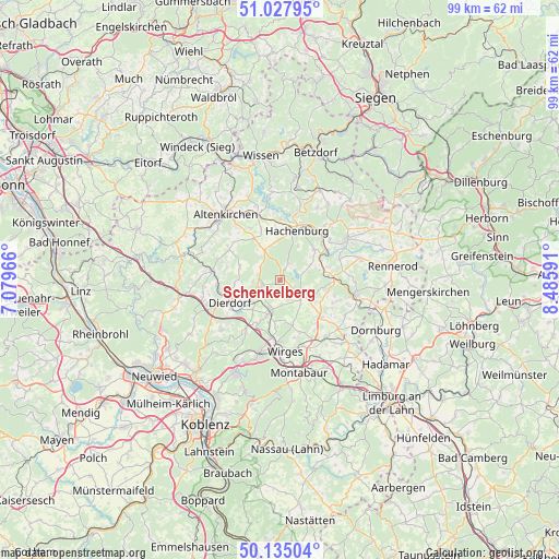
Schenkelberg GPS coordinates[2]
50° 35' 0.996" North, 7° 46' 58.008" East
| Map corner | latitude | longitude |
|---|---|---|
| Upper-left | 51.02795°, | 7.07966° |
| Center: | 50.58361°, | 7.78278° |
| Lower-right: | 50.13504°, | 8.48591° |
| Map W x H: | 99.3×99.3 km | = 61.7×61.7mi |
| max Lat: | 55.01917° ⇑50.8% North |
| Schenkelberg: | 50.58361° |
| min Lat: | ⇓49.2% South 47.40724° |
| min Long | Schenkelberg | max Long |
| 5.92978° | 7.78278° | 14.98853° |
| W 18.7%⇐ | ⇒81.3% E |
Elevation
Elevation of Schenkelberg is 416 m = 1365 ft, and this is 166.9 m = 548 ft above average elevation for this country.
| Max E: |
1256 m = 4121 ft | 22.4% |
| Schenkelberg | 416 m 1365 ft | |
| Avg. | 249.1 m = 817 ft | |
Min E: |
-5 m = -16 ft | 77.6% |
See also: Germany elevation on elevation.city.
Geographical zone
Schenkelberg is located in North temperate zone (between Tropic of Cancer and the Arctic Circle). Distance of this North polar circle is 1776.8 km =1104.1 mi to North.| Distance of | km | miles | from Schenkelberg |
|---|---|---|---|
| North Pole | 4382.7 | 2723.3 | to North |
| Arctic Circle | 1776.8 | 1104.1 | to North |
| Tropic Cancer | 3018.5 | 1875.6 | to South |
| Equator | 5624.4 | 3494.8 | to South |


Nearby cities:
15 places around Schenkelberg: (largest is in red/bold)
• Dreifelden
3.9 km =2.4 mi,  77°
77°
• Freilingen
4.5 km =2.8 mi,  126°
126°
• Freirachdorf
4.7 km =2.9 mi,  269°
269°
• Goddert
4.6 km =2.9 mi,  213°
213°
• Hartenfels
1.1 km =0.7 mi,  163°
163°
• Herschbach
3.5 km =2.2 mi, 269°
• Linden
5.1 km =3.2 mi,  68°
68°
• Maxsain
4.5 km =2.8 mi,  177°
177°
• Mündersbach
4.3 km =2.7 mi,  306°
306°
• Rückeroth
3.6 km =2.2 mi,  227°
227°
• Selters
6 km =3.7 mi,  198°
198°
• Steinebach
3.3 km =2.1 mi,  29°
29°
• Steinen
1.2 km =0.7 mi,  91°
91°
• Weidenhahn
5.4 km =3.4 mi,  138°
138°
• Wölferlingen
5.3 km =3.3 mi,  113°
113°
Sources, notices
• [Note1] Compared only with cities in Germany existing in our database
• [Src1] Map data: © OpenStreetMap contributors (CC-BY-SA)
• [Src2] Other city data from geonames.org with taken over terms of usage.
• [Src3] Geographical zone / Annual Mean Temperature by Robert A. Rohde @ Wikipedia
