Fürstenberg geodata
Fürstenberg (Lower Saxony) is a seat of a fourth-order administrative division; located in Germany in Europe/Berlin (GMT+2) time zone. With population of 1,323 people, there are 6240 cities with bigger population in this country. Compared to other cities in Germany, 69.2% of cities are located further ↓South; 59.3% of cities are located further →East and 56.1% of cities have higher elevation than Fürstenberg. Note1
Administrative division(s):
- Level 1: Lower Saxony
- Level 3: Landkreis Holzminden
- Level 4: Fürstenberg


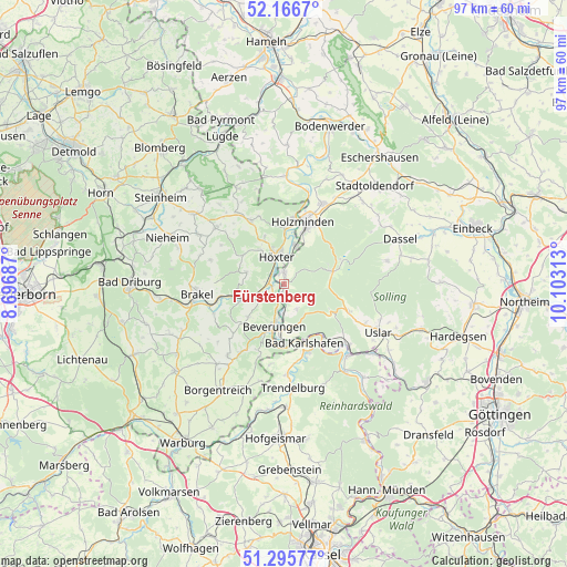
Fürstenberg GPS coordinates[2]
51° 43' 59.988" North, 9° 24' 0" East
| Map corner | latitude | longitude |
|---|---|---|
| Upper-left | 52.1667°, | 8.69687° |
| Center: | 51.73333°, | 9.4° |
| Lower-right: | 51.29577°, | 10.10313° |
| Map W x H: | 96.8×96.8 km | = 60.1×60.1mi |
| max Lat: | 55.01917° ⇑30.8% North |
| Fürstenberg: | 51.73333° |
| min Lat: | ⇓69.2% South 47.40724° |
| min Long | Fürstenberg | max Long |
| 5.92978° | 9.4° | 14.98853° |
| W 40.7%⇐ | ⇒59.3% E |
Elevation
Elevation of Fürstenberg is 181 m = 594 ft, and this is 68.1 m = 223 ft below average elevation for this country.
| Max E: |
1256 m = 4121 ft | 56.1% |
| Avg. | 249.1 m = 817 ft | |
| Fürstenberg | 181 m = 594 ft | |
Min E: |
-5 m = -16 ft | 43.9% |
See also: Germany elevation on elevation.city.
Geographical zone
Fürstenberg is located in North temperate zone (between Tropic of Cancer and the Arctic Circle). Distance of this North polar circle is 1649 km =1024.6 mi to North.| Distance of | km | miles | from Fürstenberg |
|---|---|---|---|
| North Pole | 4254.9 | 2643.9 | to North |
| Arctic Circle | 1649 | 1024.6 | to North |
| Tropic Cancer | 3146.3 | 1955 | to South |
| Equator | 5752.2 | 3574.3 | to South |


Nearby cities:
15 places around Fürstenberg: (largest is in red/bold)
• Arholzen
18.7 km =11.6 mi,  37°
37°
• Bad Karlshafen
10.8 km =6.7 mi,  159°
159°
• Bevern
15.3 km =9.5 mi,  24°
24°
• Beverungen
7.5 km =4.7 mi,  193°
193°
• Bodenfelde
14.9 km =9.3 mi,  133°
133°
• Boffzen
2.2 km =1.4 mi,  328°
328°
• Brakel
14.8 km =9.2 mi,  263°
263°
• Deensen
19.4 km =12.1 mi, 43°
• Derental
4.8 km =3 mi,  152°
152°
• Heinsen
16.8 km =10.4 mi,  7°
7°
• Holzminden
11 km =6.8 mi, 16°
• Höxter
4.8 km =3 mi,  344°
344°
• Polle
18.4 km =11.4 mi,  0°
0°
• Trendelburg
17.8 km =11.1 mi,  175°
175°
• Uslar
18.3 km =11.4 mi,  117°
117°
Sources, notices
• [Note1] Compared only with cities in Germany existing in our database
• [Src1] Map data: © OpenStreetMap contributors (CC-BY-SA)
• [Src2] Other city data from geonames.org with taken over terms of usage.
• [Src3] Geographical zone / Annual Mean Temperature by Robert A. Rohde @ Wikipedia
