Bad Karlshafen geodata
Bad Karlshafen (Hesse) is a populated place; located in Germany in Europe/Berlin (GMT+2) time zone. With population of 4,097 people, there are 3236 cities with bigger population in this country. Compared to other cities in Germany, 68.2% of cities are located further ↓South; 58.5% of cities are located further →East and 65.2% of cities have higher elevation than Bad Karlshafen. Note1
Administrative division(s):
- Level 1: Hesse
- Level 2: Regierungsbezirk Kassel
- Level 3: Landkreis Kassel
- Level 4: Bad Karlshafen


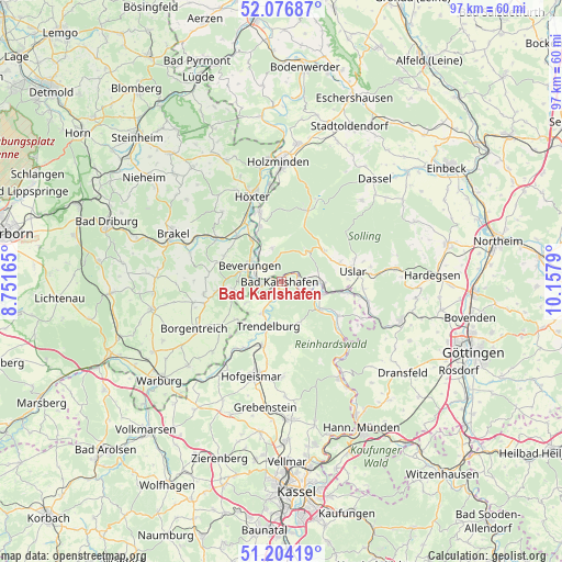
Bad Karlshafen GPS coordinates[2]
51° 38' 33.468" North, 9° 27' 17.172" East
| Map corner | latitude | longitude |
|---|---|---|
| Upper-left | 52.07687°, | 8.75165° |
| Center: | 51.64263°, | 9.45477° |
| Lower-right: | 51.20419°, | 10.1579° |
| Map W x H: | 97×97 km | = 60.3×60.3mi |
| max Lat: | 55.01917° ⇑31.8% North |
| Bad Karlshafen: | 51.64263° |
| min Lat: | ⇓68.2% South 47.40724° |
| min Long | Bad Karlshafen | max Long |
| 5.92978° | 9.45477° | 14.98853° |
| W 41.5%⇐ | ⇒58.5% E |
Elevation
Elevation of Bad Karlshafen is 119 m = 390 ft, and this is 130.1 m = 427 ft below average elevation for this country.
| Max E: |
1256 m = 4121 ft | 65.2% |
| Avg. | 249.1 m = 817 ft | |
| Bad Karlshafen | 119 m = 390 ft | |
Min E: |
-5 m = -16 ft | 34.8% |
See also: Germany elevation on elevation.city.
Geographical zone
Bad Karlshafen is located in North temperate zone (between Tropic of Cancer and the Arctic Circle). Distance of this North polar circle is 1659.1 km =1030.9 mi to North.| Distance of | km | miles | from Bad Karlshafen |
|---|---|---|---|
| North Pole | 4264.9 | 2650.1 | to North |
| Arctic Circle | 1659.1 | 1030.9 | to North |
| Tropic Cancer | 3136.2 | 1948.7 | to South |
| Equator | 5742.1 | 3568 | to South |


Nearby cities:
15 places around Bad Karlshafen: (largest is in red/bold)
• Adelebsen
21.7 km =13.5 mi,  107°
107°
• Beverungen
6.2 km =3.9 mi,  296°
296°
• Bodenfelde
7 km =4.3 mi,  92°
92°
• Boffzen
12.9 km =8 mi,  337°
337°
• Borgentreich
16.9 km =10.5 mi,  241°
241°
• Brakel
20.3 km =12.6 mi,  294°
294°
• Derental
6 km =3.7 mi, 344°
• Fürstenberg
10.8 km =6.7 mi, 339°
• Hofgeismar
17 km =10.6 mi,  196°
196°
• Holzminden
20.6 km =12.8 mi,  358°
358°
• Höxter
15.6 km =9.7 mi, 341°
• Liebenau
20.1 km =12.5 mi,  216°
216°
• Trendelburg
8 km =5 mi, 197°
• Udenhausen
19.9 km =12.4 mi,  178°
178°
• Uslar
12.5 km =7.8 mi,  82°
82°
Sources, notices
• [Note1] Compared only with cities in Germany existing in our database
• [Src1] Map data: © OpenStreetMap contributors (CC-BY-SA)
• [Src2] Other city data from geonames.org with taken over terms of usage.
• [Src3] Geographical zone / Annual Mean Temperature by Robert A. Rohde @ Wikipedia
