Friedrichshain geodata
Friedrichshain (Berlin) is a section of populated place; located in Germany in Europe/Berlin (GMT+2) time zone. With population of 117,829 people, there are 80 cities with bigger population in this country. Compared to other cities in Germany, 77.5% of cities are located further ↓South; 95.5% of cities are located further ←West and 82.3% of cities have higher elevation than Friedrichshain. Note1


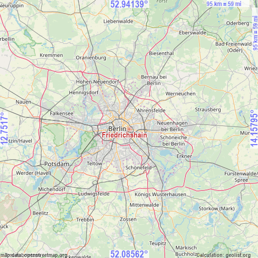
Friedrichshain GPS coordinates[2]
52° 30' 56.124" North, 13° 27' 17.352" East
| Map corner | latitude | longitude |
|---|---|---|
| Upper-left | 52.94139°, | 12.7517° |
| Center: | 52.51559°, | 13.45482° |
| Lower-right: | 52.08562°, | 14.15795° |
| Map W x H: | 95.2×95.2 km | = 59.2×59.2mi |
| max Lat: | 55.01917° ⇑22.5% North |
| Friedrichshain: | 52.51559° |
| min Lat: | ⇓77.5% South 47.40724° |
| min Long | Friedrichshain | max Long |
| 5.92978° | 13.45482° | 14.98853° |
| W 95.5%⇐ | ⇒4.5% E |
Elevation
Elevation of Friedrichshain is 41 m = 135 ft, and this is 208.1 m = 683 ft below average elevation for this country.
| Max E: |
1256 m = 4121 ft | 82.3% |
| Avg. | 249.1 m = 817 ft | |
| Friedrichshain | 41 m = 135 ft | |
Min E: |
-5 m = -16 ft | 17.7% |
See also: Friedrichshain elevation on elevation.city.
Geographical zone
Friedrichshain is located in North temperate zone (between Tropic of Cancer and the Arctic Circle). Distance of this North polar circle is 1562 km =970.6 mi to North.| Distance of | km | miles | from Friedrichshain |
|---|---|---|---|
| North Pole | 4167.9 | 2589.8 | to North |
| Arctic Circle | 1562 | 970.6 | to North |
| Tropic Cancer | 3233.3 | 2009.1 | to South |
| Equator | 5839.2 | 3628.3 | to South |


Nearby cities:
15 places around Friedrichshain: (largest is in red/bold)
• Alt-Hohenschönhausen
4.6 km =2.9 mi,  42°
42°
• Alt-Treptow
3 km =1.9 mi,  175°
175°
• Berlin
3.2 km =2 mi,  288°
288°
• Berlin Treptow
2.5 km =1.6 mi,  195°
195°
• Fennpfuhl
1.9 km =1.2 mi, 38°
• Friedrichsfelde
3.8 km =2.4 mi,  106°
106°
• Gesundbrunnen
5.8 km =3.6 mi,  312°
312°
• Kreuzberg
3.9 km =2.4 mi,  243°
243°
• Lichtenberg
3 km =1.9 mi,  93°
93°
• Mitte
3.4 km =2.1 mi,  278°
278°
• Neukölln
4.6 km =2.9 mi, 200°
• Plänterwald
4 km =2.5 mi,  162°
162°
• Prenzlauer Berg
3.3 km =2.1 mi,  321°
321°
• Rummelsburg
3 km =1.9 mi,  121°
121°
• Weißensee
4.6 km =2.9 mi,  9°
9°
In other languages:
- In France: Berlin-Friedrichshain
- In German: Berlin-Friedrichshain
- In Russian: Фридрихсхайн
- In Chinese: 腓特烈斯海因
Sources, notices
• [Note1] Compared only with cities in Germany existing in our database
• [Src1] Map data: © OpenStreetMap contributors (CC-BY-SA)
• [Src2] Other city data from geonames.org with taken over terms of usage.
• [Src3] Geographical zone / Annual Mean Temperature by Robert A. Rohde @ Wikipedia
