Fürstenwalde geodata
Fürstenwalde (Brandenburg) is a populated place; located in Germany in Europe/Berlin (GMT+2) time zone. With population of 33,539 people, there are 403 cities with bigger population in this country. Compared to other cities in Germany, 75.8% of cities are located further ↓South; 98.2% of cities are located further ←West and 81% of cities have higher elevation than Fürstenwalde. Note1
Administrative division(s):
- Level 1: Brandenburg
- Level 3: Landkreis Oder-Spree
- Level 4: Fürstenwalde/Spree


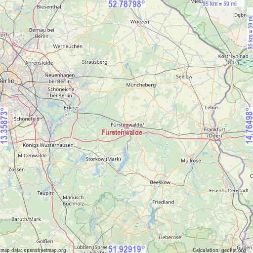
Fürstenwalde GPS coordinates[2]
52° 21' 38.412" North, 14° 3' 42.66" East
| Map corner | latitude | longitude |
|---|---|---|
| Upper-left | 52.78798°, | 13.35873° |
| Center: | 52.36067°, | 14.06185° |
| Lower-right: | 51.92919°, | 14.76498° |
| Map W x H: | 95.5×95.5 km | = 59.3×59.3mi |
| max Lat: | 55.01917° ⇑24.2% North |
| Fürstenwalde: | 52.36067° |
| min Lat: | ⇓75.8% South 47.40724° |
| min Long | Fürstenwalde | max Long |
| 5.92978° | 14.06185° | 14.98853° |
| W 98.2%⇐ | ⇒1.8% E |
Elevation
Elevation of Fürstenwalde is 44 m = 144 ft, and this is 205.1 m = 673 ft below average elevation for this country.
| Max E: |
1256 m = 4121 ft | 81% |
| Avg. | 249.1 m = 817 ft | |
| Fürstenwalde | 44 m = 144 ft | |
Min E: |
-5 m = -16 ft | 19% |
See also: Germany elevation on elevation.city.
Geographical zone
Fürstenwalde is located in North temperate zone (between Tropic of Cancer and the Arctic Circle). Distance of this North polar circle is 1579.2 km =981.3 mi to North.| Distance of | km | miles | from Fürstenwalde |
|---|---|---|---|
| North Pole | 4185.1 | 2600.5 | to North |
| Arctic Circle | 1579.2 | 981.3 | to North |
| Tropic Cancer | 3216 | 1998.3 | to South |
| Equator | 5822 | 3617.6 | to South |


Nearby cities:
15 places around Fürstenwalde: (largest is in red/bold)
• Bad Saarow
8.6 km =5.3 mi,  177°
177°
• Berkenbrück
6.1 km =3.8 mi,  101°
101°
• Briesen
14.8 km =9.2 mi, 97°
• Diensdorf-Radlow
12.3 km =7.6 mi, 183°
• Falkenhagen
19.1 km =11.9 mi,  64°
64°
• Grünheide
18.3 km =11.4 mi,  292°
292°
• Langewahl
4 km =2.5 mi,  139°
139°
• Müncheberg
17.1 km =10.6 mi,  17°
17°
• Rauen
3.9 km =2.4 mi,  216°
216°
• Reichenwalde
11.3 km =7 mi,  201°
201°
• Rietz Neuendorf
16.7 km =10.4 mi,  152°
152°
• Spreenhagen
12.7 km =7.9 mi,  261°
261°
• Steinhöfel
8.4 km =5.2 mi, 58°
• Storkow
14.5 km =9 mi, 217°
• Wendisch Rietz
16.5 km =10.3 mi,  192°
192°
In other languages:
- In German: Fürstenwalde/Spree, Fürstenwalde
- In Italian: Fürstenwalde/Spree
- In Russian: Фюрстенвальде
- In Chinese: 菲尔斯滕瓦尔德
Sources, notices
• [Note1] Compared only with cities in Germany existing in our database
• [Src1] Map data: © OpenStreetMap contributors (CC-BY-SA)
• [Src2] Other city data from geonames.org with taken over terms of usage.
• [Src3] Geographical zone / Annual Mean Temperature by Robert A. Rohde @ Wikipedia
