Weingarten geodata
Weingarten (Baden-Württemberg) is a populated place; located in Germany in Europe/Berlin (GMT+2) time zone. With population of 9,556 people, there are 1692 cities with bigger population in this country. Compared to other cities in Germany, 82.3% of cities are located further ↑North; 70.9% of cities are located further →East and 65.8% of cities have higher elevation than Weingarten. Note1
Administrative division(s):
- Level 1: Baden-Württemberg
- Level 2: Karlsruhe Region
- Level 3: Landkreis Karlsruhe
- Level 4: Weingarten (Baden)


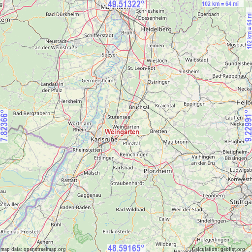
Weingarten GPS coordinates[2]
49° 3' 16.452" North, 8° 31' 36.408" East
| Map corner | latitude | longitude |
|---|---|---|
| Upper-left | 49.51322°, | 7.82366° |
| Center: | 49.05457°, | 8.52678° |
| Lower-right: | 48.59165°, | 9.22991° |
| Map W x H: | 102.5×102.5 km | = 63.7×63.7mi |
| max Lat: | 55.01917° ⇑82.3% North |
| Weingarten: | 49.05457° |
| min Lat: | ⇓17.7% South 47.40724° |
| min Long | Weingarten | max Long |
| 5.92978° | 8.52678° | 14.98853° |
| W 29.1%⇐ | ⇒70.9% E |
Elevation
Elevation of Weingarten is 115 m = 377 ft, and this is 134.1 m = 440 ft below average elevation for this country.
| Max E: |
1256 m = 4121 ft | 65.8% |
| Avg. | 249.1 m = 817 ft | |
| Weingarten | 115 m = 377 ft | |
Min E: |
-5 m = -16 ft | 34.2% |
See also: Germany elevation on elevation.city.
Geographical zone
Weingarten is located in North temperate zone (between Tropic of Cancer and the Arctic Circle). Distance of this North polar circle is 1946.8 km =1209.7 mi to North.| Distance of | km | miles | from Weingarten |
|---|---|---|---|
| North Pole | 4552.7 | 2828.9 | to North |
| Arctic Circle | 1946.8 | 1209.7 | to North |
| Tropic Cancer | 2848.4 | 1769.9 | to South |
| Equator | 5454.4 | 3389.2 | to South |


Nearby cities:
15 places around Weingarten: (largest is in red/bold)
• Bretten
13.3 km =8.3 mi,  98°
98°
• Bruchsal
9.3 km =5.8 mi,  33°
33°
• Dürrenbüchig
9.6 km =6 mi,  113°
113°
• Eggenstein-Leopoldshafen
10.1 km =6.3 mi,  292°
292°
• Forst
12.2 km =7.6 mi,  18°
18°
• Gondelsheim
9.6 km =6 mi,  86°
86°
• Graben-Neudorf
12.7 km =7.9 mi,  348°
348°
• Hambrücken
15.1 km =9.4 mi,  3°
3°
• Jöhlingen
4.2 km =2.6 mi,  126°
126°
• Karlsdorf-Neuthard
8.9 km =5.5 mi, 1°
• Karlsruhe
10.2 km =6.3 mi,  240°
240°
• Königsbach-Stein
11.4 km =7.1 mi,  149°
149°
• Linkenheim-Hochstetten
12 km =7.5 mi,  315°
315°
• Ubstadt-Weiher
14.3 km =8.9 mi, 32°
• Wössingen
7.6 km =4.7 mi, 128°
Sources, notices
• [Note1] Compared only with cities in Germany existing in our database
• [Src1] Map data: © OpenStreetMap contributors (CC-BY-SA)
• [Src2] Other city data from geonames.org with taken over terms of usage.
• [Src3] Geographical zone / Annual Mean Temperature by Robert A. Rohde @ Wikipedia
