Erlabrunn geodata
Erlabrunn (Saxony) is a populated place; located in Germany in Europe/Berlin (GMT+2) time zone. With population of 964 people, there are 7295 cities with bigger population in this country. Compared to other cities in Germany, 53.3% of cities are located further ↑North; 89.8% of cities are located further ←West and 96.7% of cities have lower elevation than Erlabrunn. Note1


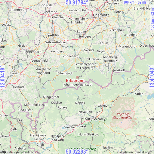
Erlabrunn GPS coordinates[2]
50° 28' 21.18" North, 12° 42' 26.28" East
| Map corner | latitude | longitude |
|---|---|---|
| Upper-left | 50.91794°, | 12.00418° |
| Center: | 50.47255°, | 12.7073° |
| Lower-right: | 50.02293°, | 13.41043° |
| Map W x H: | 99.5×99.5 km | = 61.8×61.8mi |
| max Lat: | 55.01917° ⇑53.3% North |
| Erlabrunn: | 50.47255° |
| min Lat: | ⇓46.7% South 47.40724° |
| min Long | Erlabrunn | max Long |
| 5.92978° | 12.7073° | 14.98853° |
| W 89.8%⇐ | ⇒10.2% E |
Elevation
Elevation of Erlabrunn is 652 m = 2139 ft, and this is 402.9 m = 1322 ft above average elevation for this country.
| Max E: |
1256 m = 4121 ft | 3.3% |
| Erlabrunn | 652 m 2139 ft | |
| Avg. | 249.1 m = 817 ft | |
Min E: |
-5 m = -16 ft | 96.7% |
See also: Germany elevation on elevation.city.
Geographical zone
Erlabrunn is located in North temperate zone (between Tropic of Cancer and the Arctic Circle). Distance of this North polar circle is 1789.2 km =1111.8 mi to North.| Distance of | km | miles | from Erlabrunn |
|---|---|---|---|
| North Pole | 4395 | 2730.9 | to North |
| Arctic Circle | 1789.2 | 1111.8 | to North |
| Tropic Cancer | 3006.1 | 1867.9 | to South |
| Equator | 5612 | 3487.1 | to South |


Nearby cities:
15 places around Erlabrunn: (largest is in red/bold)
• Aue
13.1 km =8.1 mi,  359°
359°
• Beierfeld
11.9 km =7.4 mi,  29°
29°
• Bernsbach
12.3 km =7.6 mi,  20°
20°
• Bockau
7.9 km =4.9 mi,  349°
349°
• Breitenbrunn
4.2 km =2.6 mi,  85°
85°
• Eibenstock
8 km =5 mi,  287°
287°
• Johanngeorgenstadt
4.5 km =2.8 mi,  176°
176°
• Lauter
10.2 km =6.3 mi,  11°
11°
• Markersbach
13 km =8.1 mi,  57°
57°
• Pöhla
9 km =5.6 mi, 61°
• Raschau
11 km =6.8 mi,  53°
53°
• Rittersgrün
6.2 km =3.9 mi,  81°
81°
• Schwarzenberg
9.1 km =5.7 mi,  37°
37°
• Sosa
5 km =3.1 mi,  306°
306°
• Zschorlau
11.2 km =7 mi,  338°
338°
Sources, notices
• [Note1] Compared only with cities in Germany existing in our database
• [Src1] Map data: © OpenStreetMap contributors (CC-BY-SA)
• [Src2] Other city data from geonames.org with taken over terms of usage.
• [Src3] Geographical zone / Annual Mean Temperature by Robert A. Rohde @ Wikipedia
