Prackenbach geodata
Prackenbach (Bavaria) is a seat of a fourth-order administrative division; located in Germany in Europe/Berlin (GMT+2) time zone. With population of 2,688 people, there are 4244 cities with bigger population in this country. Compared to other cities in Germany, 81.8% of cities are located further ↑North; 91% of cities are located further ←West and 88.4% of cities have lower elevation than Prackenbach. Note1
Administrative division(s):
- Level 1: Bavaria
- Level 2: Lower Bavaria
- Level 3: Landkreis Regen
- Level 4: Prackenbach


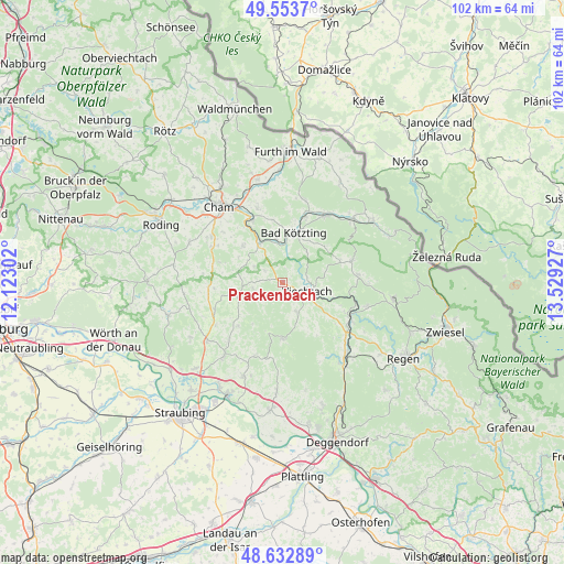
Prackenbach GPS coordinates[2]
49° 5' 43.548" North, 12° 49' 34.104" East
| Map corner | latitude | longitude |
|---|---|---|
| Upper-left | 49.5537°, | 12.12302° |
| Center: | 49.09543°, | 12.82614° |
| Lower-right: | 48.63289°, | 13.52927° |
| Map W x H: | 102.4×102.4 km | = 63.6×63.6mi |
| max Lat: | 55.01917° ⇑81.8% North |
| Prackenbach: | 49.09543° |
| min Lat: | ⇓18.2% South 47.40724° |
| min Long | Prackenbach | max Long |
| 5.92978° | 12.82614° | 14.98853° |
| W 91%⇐ | ⇒9% E |
Elevation
Elevation of Prackenbach is 498 m = 1634 ft, and this is 248.9 m = 817 ft above average elevation for this country.
| Max E: |
1256 m = 4121 ft | 11.6% |
| Prackenbach | 498 m 1634 ft | |
| Avg. | 249.1 m = 817 ft | |
Min E: |
-5 m = -16 ft | 88.4% |
See also: Germany elevation on elevation.city.
Geographical zone
Prackenbach is located in North temperate zone (between Tropic of Cancer and the Arctic Circle). Distance of this North polar circle is 1942.3 km =1206.9 mi to North.| Distance of | km | miles | from Prackenbach |
|---|---|---|---|
| North Pole | 4548.2 | 2826.1 | to North |
| Arctic Circle | 1942.3 | 1206.9 | to North |
| Tropic Cancer | 2853 | 1772.8 | to South |
| Equator | 5458.9 | 3392 | to South |


Nearby cities:
15 places around Prackenbach: (largest is in red/bold)
• Arnbruck
13.1 km =8.1 mi,  72°
72°
• Blaibach
8 km =5 mi,  355°
355°
• Chamerau
12.9 km =8 mi,  334°
334°
• Geiersthal
12.6 km =7.8 mi,  116°
116°
• Grafenwiesen
12.3 km =7.6 mi,  19°
19°
• Haibach
11.3 km =7 mi,  225°
225°
• Kollnburg
6 km =3.7 mi,  154°
154°
• Konzell
8.8 km =5.5 mi,  252°
252°
• Kötzting
9.3 km =5.8 mi,  13°
13°
• Loitzendorf
12.5 km =7.8 mi,  264°
264°
• Miltach
8.5 km =5.3 mi, 330°
• Rattenberg
5.7 km =3.5 mi, 259°
• Sankt Englmar
10.3 km =6.4 mi,  179°
179°
• Viechtach
4.7 km =2.9 mi,  111°
111°
• Zandt
9.1 km =5.7 mi,  311°
311°
Sources, notices
• [Note1] Compared only with cities in Germany existing in our database
• [Src1] Map data: © OpenStreetMap contributors (CC-BY-SA)
• [Src2] Other city data from geonames.org with taken over terms of usage.
• [Src3] Geographical zone / Annual Mean Temperature by Robert A. Rohde @ Wikipedia
