Rattenberg geodata
Rattenberg (Bavaria) is a seat of a fourth-order administrative division; located in Germany in Europe/Berlin (GMT+2) time zone. With population of 1,841 people, there are 5288 cities with bigger population in this country. Compared to other cities in Germany, 81.9% of cities are located further ↑North; 90.3% of cities are located further ←West and 91.9% of cities have lower elevation than Rattenberg. Note1
Administrative division(s):
- Level 1: Bavaria
- Level 2: Lower Bavaria
- Level 3: Landkreis Straubing-Bogen
- Level 4: Rattenberg


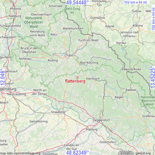
Rattenberg GPS coordinates[2]
49° 5' 10.032" North, 12° 44' 56.832" East
| Map corner | latitude | longitude |
|---|---|---|
| Upper-left | 49.54448°, | 12.046° |
| Center: | 49.08612°, | 12.74912° |
| Lower-right: | 48.62349°, | 13.45225° |
| Map W x H: | 102.4×102.4 km | = 63.6×63.6mi |
| max Lat: | 55.01917° ⇑81.9% North |
| Rattenberg: | 49.08612° |
| min Lat: | ⇓18.1% South 47.40724° |
| min Long | Rattenberg | max Long |
| 5.92978° | 12.74912° | 14.98853° |
| W 90.3%⇐ | ⇒9.7% E |
Elevation
Elevation of Rattenberg is 541 m = 1775 ft, and this is 291.9 m = 958 ft above average elevation for this country.
| Max E: |
1256 m = 4121 ft | 8.1% |
| Rattenberg | 541 m 1775 ft | |
| Avg. | 249.1 m = 817 ft | |
Min E: |
-5 m = -16 ft | 91.9% |
See also: Germany elevation on elevation.city.
Geographical zone
Rattenberg is located in North temperate zone (between Tropic of Cancer and the Arctic Circle). Distance of this North polar circle is 1943.3 km =1207.5 mi to North.| Distance of | km | miles | from Rattenberg |
|---|---|---|---|
| North Pole | 4549.2 | 2826.7 | to North |
| Arctic Circle | 1943.3 | 1207.5 | to North |
| Tropic Cancer | 2851.9 | 1772.1 | to South |
| Equator | 5457.9 | 3391.4 | to South |


Nearby cities:
15 places around Rattenberg: (largest is in red/bold)
• Blaibach
10.2 km =6.3 mi,  28°
28°
• Haibach
7.3 km =4.5 mi,  199°
199°
• Haselbach
10.1 km =6.3 mi, 204°
• Kollnburg
9.3 km =5.8 mi,  118°
118°
• Konzell
3.2 km =2 mi,  241°
241°
• Loitzendorf
6.8 km =4.2 mi,  268°
268°
• Miltach
8.5 km =5.3 mi,  9°
9°
• Neukirchen
12.4 km =7.7 mi,  177°
177°
• Prackenbach
5.7 km =3.5 mi,  79°
79°
• Rattiszell
9.4 km =5.8 mi,  224°
224°
• Sankt Englmar
10.8 km =6.7 mi,  148°
148°
• Stallwang
7.9 km =4.9 mi, 240°
• Traitsching
10.1 km =6.3 mi,  314°
314°
• Viechtach
10 km =6.2 mi,  93°
93°
• Zandt
7.2 km =4.5 mi,  350°
350°
Sources, notices
• [Note1] Compared only with cities in Germany existing in our database
• [Src1] Map data: © OpenStreetMap contributors (CC-BY-SA)
• [Src2] Other city data from geonames.org with taken over terms of usage.
• [Src3] Geographical zone / Annual Mean Temperature by Robert A. Rohde @ Wikipedia
