Elsdorf geodata
Elsdorf (North Rhine-Westphalia) is a seat of a fourth-order administrative division; located in Germany in Europe/Berlin (GMT+2) time zone. With population of 21,967 people, there are 684 cities with bigger population in this country. Compared to other cities in Germany, 57% of cities are located further ↓South; 97.3% of cities are located further →East and 72% of cities have higher elevation than Elsdorf. Note1
Administrative division(s):
- Level 1: North Rhine-Westphalia
- Level 2: Regierungsbezirk Köln
- Level 3: Rhein-Erft-Kreis
- Level 4: Elsdorf


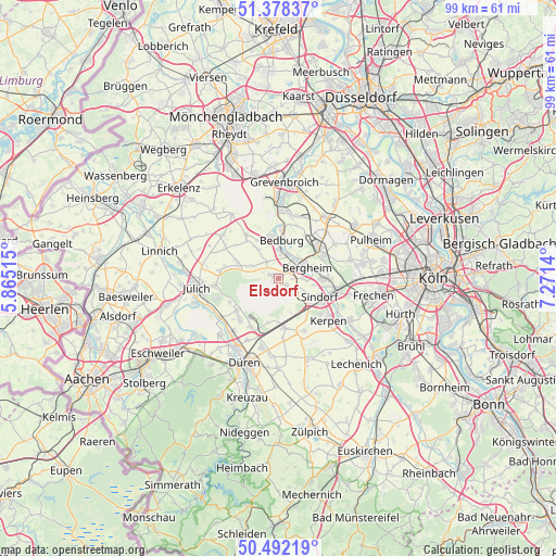
Elsdorf GPS coordinates[2]
50° 56' 14.604" North, 6° 34' 5.808" East
| Map corner | latitude | longitude |
|---|---|---|
| Upper-left | 51.37837°, | 5.86515° |
| Center: | 50.93739°, | 6.56828° |
| Lower-right: | 50.49219°, | 7.2714° |
| Map W x H: | 98.5×98.5 km | = 61.2×61.2mi |
| max Lat: | 55.01917° ⇑43% North |
| Elsdorf: | 50.93739° |
| min Lat: | ⇓57% South 47.40724° |
| min Long | Elsdorf | max Long |
| 5.92978° | 6.56828° | 14.98853° |
| W 2.7%⇐ | ⇒97.3% E |
Elevation
Elevation of Elsdorf is 78 m = 256 ft, and this is 171.1 m = 561 ft below average elevation for this country.
| Max E: |
1256 m = 4121 ft | 72% |
| Avg. | 249.1 m = 817 ft | |
| Elsdorf | 78 m = 256 ft | |
Min E: |
-5 m = -16 ft | 28% |
See also: Germany elevation on elevation.city.
Geographical zone
Elsdorf is located in North temperate zone (between Tropic of Cancer and the Arctic Circle). Distance of this North polar circle is 1737.5 km =1079.6 mi to North.| Distance of | km | miles | from Elsdorf |
|---|---|---|---|
| North Pole | 4343.4 | 2698.9 | to North |
| Arctic Circle | 1737.5 | 1079.6 | to North |
| Tropic Cancer | 3057.8 | 1900 | to South |
| Equator | 5663.7 | 3519.3 | to South |


Nearby cities:
15 places around Elsdorf: (largest is in red/bold)
• Bedburg
6.1 km =3.8 mi,  1°
1°
• Bergheim
5.4 km =3.4 mi,  67°
67°
• Düren
15.7 km =9.8 mi,  199°
199°
• Frechen
17.3 km =10.7 mi,  98°
98°
• Grevenbroich
17.1 km =10.6 mi, 3°
• Inden
18 km =11.2 mi,  234°
234°
• Jülich
14.5 km =9 mi,  263°
263°
• Kerpen
11.7 km =7.3 mi,  129°
129°
• Merzenich
12.7 km =7.9 mi,  193°
193°
• Niederzier
9.3 km =5.8 mi, 229°
• Nörvenich
15.4 km =9.6 mi,  161°
161°
• Pulheim
18 km =11.2 mi, 67°
• Rommerskirchen
13.4 km =8.3 mi,  37°
37°
• Titz
12.6 km =7.8 mi,  307°
307°
• Türnich
15.8 km =9.8 mi,  123°
123°
Sources, notices
• [Note1] Compared only with cities in Germany existing in our database
• [Src1] Map data: © OpenStreetMap contributors (CC-BY-SA)
• [Src2] Other city data from geonames.org with taken over terms of usage.
• [Src3] Geographical zone / Annual Mean Temperature by Robert A. Rohde @ Wikipedia
