Kerpen geodata
Kerpen (North Rhine-Westphalia) is a populated place; located in Germany in Europe/Berlin (GMT+2) time zone. With population of 64,226 people, there are 162 cities with bigger population in this country. Compared to other cities in Germany, 55.5% of cities are located further ↓South; 96.4% of cities are located further →East and 71.1% of cities have higher elevation than Kerpen. Note1
Administrative division(s):
- Level 1: North Rhine-Westphalia
- Level 2: Regierungsbezirk Köln
- Level 3: Rhein-Erft-Kreis
- Level 4: Kerpen


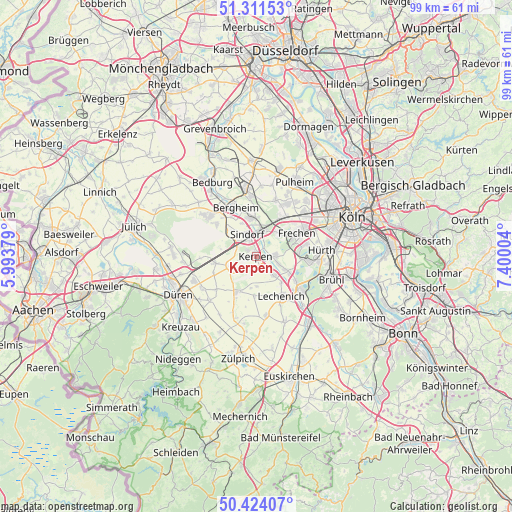
Kerpen GPS coordinates[2]
50° 52' 11.676" North, 6° 41' 48.876" East
| Map corner | latitude | longitude |
|---|---|---|
| Upper-left | 51.31153°, | 5.99379° |
| Center: | 50.86991°, | 6.69691° |
| Lower-right: | 50.42407°, | 7.40004° |
| Map W x H: | 98.7×98.7 km | = 61.3×61.3mi |
| max Lat: | 55.01917° ⇑44.5% North |
| Kerpen: | 50.86991° |
| min Lat: | ⇓55.5% South 47.40724° |
| min Long | Kerpen | max Long |
| 5.92978° | 6.69691° | 14.98853° |
| W 3.6%⇐ | ⇒96.4% E |
Elevation
Elevation of Kerpen is 84 m = 276 ft, and this is 165.1 m = 542 ft below average elevation for this country.
| Max E: |
1256 m = 4121 ft | 71.1% |
| Avg. | 249.1 m = 817 ft | |
| Kerpen | 84 m = 276 ft | |
Min E: |
-5 m = -16 ft | 28.9% |
See also: Kerpen elevation on elevation.city.
Geographical zone
Kerpen is located in North temperate zone (between Tropic of Cancer and the Arctic Circle). Distance of this North polar circle is 1745 km =1084.3 mi to North.| Distance of | km | miles | from Kerpen |
|---|---|---|---|
| North Pole | 4350.9 | 2703.5 | to North |
| Arctic Circle | 1745 | 1084.3 | to North |
| Tropic Cancer | 3050.3 | 1895.4 | to South |
| Equator | 5656.2 | 3514.6 | to South |


Nearby cities:
15 places around Kerpen: (largest is in red/bold)
• Bedburg
16.2 km =10.1 mi,  327°
327°
• Bergheim
10.3 km =6.4 mi,  337°
337°
• Brühl
15.3 km =9.5 mi,  107°
107°
• Düren
16.1 km =10 mi,  243°
243°
• Elsdorf
11.7 km =7.3 mi,  309°
309°
• Erftstadt
9.2 km =5.7 mi,  131°
131°
• Frechen
9.5 km =5.9 mi,  58°
58°
• Hürth
12 km =7.5 mi,  89°
89°
• Merzenich
13 km =8.1 mi,  248°
248°
• Niederzier
16.2 km =10.1 mi,  275°
275°
• Nörvenich
8.2 km =5.1 mi,  209°
209°
• Pulheim
16.3 km =10.1 mi,  27°
27°
• Türnich
4.3 km =2.7 mi, 106°
• Vettweiß
16.6 km =10.3 mi,  204°
204°
• Weilerswist
16.7 km =10.4 mi,  141°
141°
Sources, notices
• [Note1] Compared only with cities in Germany existing in our database
• [Src1] Map data: © OpenStreetMap contributors (CC-BY-SA)
• [Src2] Other city data from geonames.org with taken over terms of usage.
• [Src3] Geographical zone / Annual Mean Temperature by Robert A. Rohde @ Wikipedia
