Ellhofen geodata
Ellhofen (Baden-Württemberg) is a seat of a fourth-order administrative division; located in Germany in Europe/Berlin (GMT+2) time zone. With population of 3,321 people, there are 3741 cities with bigger population in this country. Compared to other cities in Germany, 81.2% of cities are located further ↑North; 60.4% of cities are located further →East and 55.7% of cities have higher elevation than Ellhofen. Note1
Administrative division(s):
- Level 1: Baden-Württemberg
- Level 2: Regierungsbezirk Stuttgart
- Level 3: Landkreis Heilbronn
- Level 4: Ellhofen


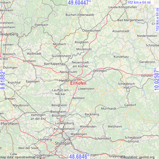
Ellhofen GPS coordinates[2]
49° 8' 48.012" North, 9° 19' 18.984" East
| Map corner | latitude | longitude |
|---|---|---|
| Upper-left | 49.60447°, | 8.61882° |
| Center: | 49.14667°, | 9.32194° |
| Lower-right: | 48.6846°, | 10.02507° |
| Map W x H: | 102.3×102.3 km | = 63.6×63.6mi |
| max Lat: | 55.01917° ⇑81.2% North |
| Ellhofen: | 49.14667° |
| min Lat: | ⇓18.8% South 47.40724° |
| min Long | Ellhofen | max Long |
| 5.92978° | 9.32194° | 14.98853° |
| W 39.6%⇐ | ⇒60.4% E |
Elevation
Elevation of Ellhofen is 184 m = 604 ft, and this is 65.1 m = 214 ft below average elevation for this country.
| Max E: |
1256 m = 4121 ft | 55.7% |
| Avg. | 249.1 m = 817 ft | |
| Ellhofen | 184 m = 604 ft | |
Min E: |
-5 m = -16 ft | 44.3% |
See also: Germany elevation on elevation.city.
Geographical zone
Ellhofen is located in North temperate zone (between Tropic of Cancer and the Arctic Circle). Distance of this North polar circle is 1936.6 km =1203.3 mi to North.| Distance of | km | miles | from Ellhofen |
|---|---|---|---|
| North Pole | 4542.5 | 2822.6 | to North |
| Arctic Circle | 1936.6 | 1203.3 | to North |
| Tropic Cancer | 2858.7 | 1776.3 | to South |
| Equator | 5464.6 | 3395.5 | to South |


Nearby cities:
15 places around Ellhofen: (largest is in red/bold)
• Abstatt
9 km =5.6 mi,  194°
194°
• Bretzfeld
9.2 km =5.7 mi,  66°
66°
• Eberstadt
3.7 km =2.3 mi,  359°
359°
• Erlenbach
4.8 km =3 mi,  306°
306°
• Flein
9.4 km =5.8 mi,  239°
239°
• Heilbronn
7.4 km =4.6 mi,  264°
264°
• Ilsfeld
11.5 km =7.1 mi,  208°
208°
• Langenbrettach
11.3 km =7 mi,  38°
38°
• Lehrensteinsfeld
1.8 km =1.1 mi,  167°
167°
• Löwenstein
7.1 km =4.4 mi,  143°
143°
• Neckarsulm
8.5 km =5.3 mi,  303°
303°
• Neuenstadt am Kocher
9.8 km =6.1 mi,  4°
4°
• Untereisesheim
11.3 km =7 mi, 309°
• Untergruppenbach
7.2 km =4.5 mi, 208°
• Weinsberg
2.5 km =1.6 mi,  281°
281°
Sources, notices
• [Note1] Compared only with cities in Germany existing in our database
• [Src1] Map data: © OpenStreetMap contributors (CC-BY-SA)
• [Src2] Other city data from geonames.org with taken over terms of usage.
• [Src3] Geographical zone / Annual Mean Temperature by Robert A. Rohde @ Wikipedia
