Löwenstein geodata
Löwenstein (Baden-Württemberg) is a populated place; located in Germany in Europe/Berlin (GMT+2) time zone. With population of 3,070 people, there are 3941 cities with bigger population in this country. Compared to other cities in Germany, 81.8% of cities are located further ↑North; 59.6% of cities are located further →East and 71.1% of cities have lower elevation than Löwenstein. Note1
Administrative division(s):
- Level 1: Baden-Württemberg
- Level 2: Regierungsbezirk Stuttgart
- Level 3: Landkreis Heilbronn
- Level 4: Löwenstein


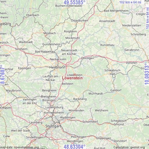
Löwenstein GPS coordinates[2]
49° 5' 44.088" North, 9° 22' 48" East
| Map corner | latitude | longitude |
|---|---|---|
| Upper-left | 49.55385°, | 8.67687° |
| Center: | 49.09558°, | 9.38° |
| Lower-right: | 48.63304°, | 10.08313° |
| Map W x H: | 102.4×102.4 km | = 63.6×63.6mi |
| max Lat: | 55.01917° ⇑81.8% North |
| Löwenstein: | 49.09558° |
| min Lat: | ⇓18.2% South 47.40724° |
| min Long | Löwenstein | max Long |
| 5.92978° | 9.38° | 14.98853° |
| W 40.4%⇐ | ⇒59.6% E |
Elevation
Elevation of Löwenstein is 367 m = 1204 ft, and this is 117.9 m = 387 ft above average elevation for this country.
| Max E: |
1256 m = 4121 ft | 28.9% |
| Löwenstein | 367 m 1204 ft | |
| Avg. | 249.1 m = 817 ft | |
Min E: |
-5 m = -16 ft | 71.1% |
See also: Germany elevation on elevation.city.
Geographical zone
Löwenstein is located in North temperate zone (between Tropic of Cancer and the Arctic Circle). Distance of this North polar circle is 1942.3 km =1206.9 mi to North.| Distance of | km | miles | from Löwenstein |
|---|---|---|---|
| North Pole | 4548.1 | 2826.1 | to North |
| Arctic Circle | 1942.3 | 1206.9 | to North |
| Tropic Cancer | 2853 | 1772.8 | to South |
| Equator | 5458.9 | 3392 | to South |


Nearby cities:
15 places around Löwenstein: (largest is in red/bold)
• Abstatt
7.2 km =4.5 mi,  244°
244°
• Beilstein
7.7 km =4.8 mi,  218°
218°
• Bretzfeld
10.2 km =6.3 mi,  24°
24°
• Eberstadt
10.3 km =6.4 mi,  335°
335°
• Ellhofen
7.1 km =4.4 mi,  323°
323°
• Erlenbach
11.8 km =7.3 mi, 316°
• Großbottwar
12.2 km =7.6 mi,  211°
211°
• Großerlach
10.8 km =6.7 mi,  115°
115°
• Ilsfeld
10.7 km =6.6 mi,  245°
245°
• Lehrensteinsfeld
5.5 km =3.4 mi, 315°
• Oberstenfeld
8.8 km =5.5 mi, 209°
• Spiegelberg
7.7 km =4.8 mi,  142°
142°
• Untergruppenbach
7.7 km =4.8 mi,  264°
264°
• Weinsberg
9.1 km =5.7 mi,  312°
312°
• Wüstenrot
6.1 km =3.8 mi,  105°
105°
Sources, notices
• [Note1] Compared only with cities in Germany existing in our database
• [Src1] Map data: © OpenStreetMap contributors (CC-BY-SA)
• [Src2] Other city data from geonames.org with taken over terms of usage.
• [Src3] Geographical zone / Annual Mean Temperature by Robert A. Rohde @ Wikipedia
