Deetz geodata
Deetz (Saxony-Anhalt) is a populated place; located in Germany in Europe/Berlin (GMT+2) time zone. With population of 725 people, there are 8216 cities with bigger population in this country. Compared to other cities in Germany, 72.5% of cities are located further ↓South; 84.2% of cities are located further ←West and 70% of cities have higher elevation than Deetz. Note1


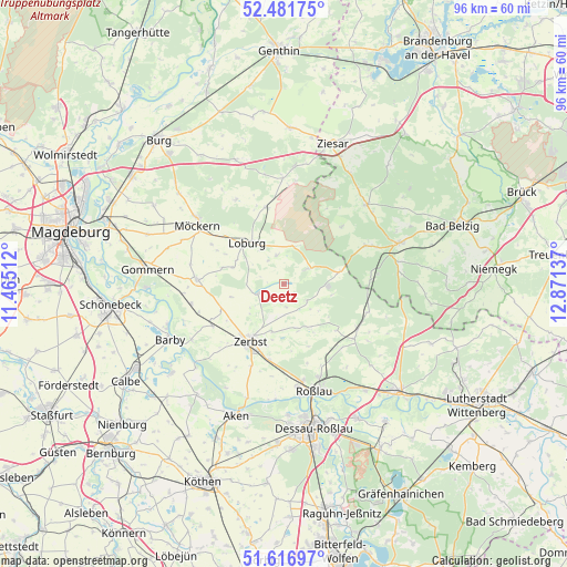
Deetz GPS coordinates[2]
52° 3' 5.22" North, 12° 10' 5.664" East
| Map corner | latitude | longitude |
|---|---|---|
| Upper-left | 52.48175°, | 11.46512° |
| Center: | 52.05145°, | 12.16824° |
| Lower-right: | 51.61697°, | 12.87137° |
| Map W x H: | 96.2×96.2 km | = 59.8×59.8mi |
| max Lat: | 55.01917° ⇑27.5% North |
| Deetz: | 52.05145° |
| min Lat: | ⇓72.5% South 47.40724° |
| min Long | Deetz | max Long |
| 5.92978° | 12.16824° | 14.98853° |
| W 84.2%⇐ | ⇒15.8% E |
Elevation
Elevation of Deetz is 91 m = 299 ft, and this is 158.1 m = 519 ft below average elevation for this country.
| Max E: |
1256 m = 4121 ft | 70% |
| Avg. | 249.1 m = 817 ft | |
| Deetz | 91 m = 299 ft | |
Min E: |
-5 m = -16 ft | 30% |
See also: Germany elevation on elevation.city.
Geographical zone
Deetz is located in North temperate zone (between Tropic of Cancer and the Arctic Circle). Distance of this North polar circle is 1613.6 km =1002.6 mi to North.| Distance of | km | miles | from Deetz |
|---|---|---|---|
| North Pole | 4219.5 | 2621.9 | to North |
| Arctic Circle | 1613.6 | 1002.6 | to North |
| Tropic Cancer | 3181.7 | 1977 | to South |
| Equator | 5787.6 | 3596.2 | to South |


Nearby cities:
15 places around Deetz: (largest is in red/bold)
• Bornum
8.4 km =5.2 mi,  162°
162°
• Güterglück
14 km =8.7 mi,  239°
239°
• Hohenziatz
16.6 km =10.3 mi,  330°
330°
• Jeber-Bergfrieden
14.5 km =9 mi,  121°
121°
• Jütrichau
13 km =8.1 mi,  191°
191°
• Leitzkau
14.8 km =9.2 mi,  272°
272°
• Lindau
4.4 km =2.7 mi,  249°
249°
• Loburg
9.4 km =5.8 mi,  319°
319°
• Möckern
17.8 km =11.1 mi,  303°
303°
• Rodleben
17.4 km =10.8 mi,  172°
172°
• Rosian
5.1 km =3.2 mi,  347°
347°
• Thießen
13.9 km =8.6 mi,  139°
139°
• Walternienburg
18.3 km =11.4 mi, 239°
• Zeppernick
12.9 km =8 mi,  309°
309°
• Zerbst
11.1 km =6.9 mi,  210°
210°
Sources, notices
• [Note1] Compared only with cities in Germany existing in our database
• [Src1] Map data: © OpenStreetMap contributors (CC-BY-SA)
• [Src2] Other city data from geonames.org with taken over terms of usage.
• [Src3] Geographical zone / Annual Mean Temperature by Robert A. Rohde @ Wikipedia
