Coesfeld geodata
Coesfeld (North Rhine-Westphalia) is a seat of a third-order administrative division; located in Germany in Europe/Berlin (GMT+1) time zone. With population of 36,631 people, there are 363 cities with bigger population in this country. Compared to other cities in Germany, 71.6% of cities are located further ↓South; 91.7% of cities are located further →East and 71.2% of cities have higher elevation than Coesfeld. Note1
Administrative division(s):
- Level 1: North Rhine-Westphalia
- Level 2: Regierungsbezirk Münster
- Level 3: Kreis Coesfeld
- Level 4: Coesfeld


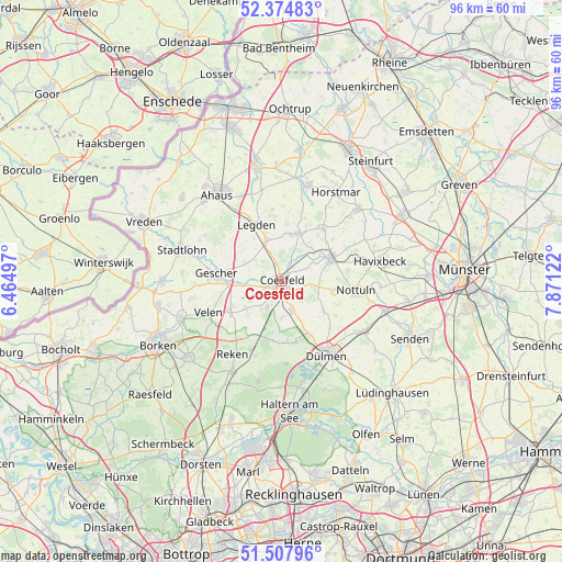
Coesfeld GPS coordinates[2]
51° 56' 36.564" North, 7° 10' 5.124" East
| Map corner | latitude | longitude |
|---|---|---|
| Upper-left | 52.37483°, | 6.46497° |
| Center: | 51.94349°, | 7.16809° |
| Lower-right: | 51.50796°, | 7.87122° |
| Map W x H: | 96.4×96.4 km | = 59.9×59.9mi |
| max Lat: | 55.01917° ⇑28.4% North |
| Coesfeld: | 51.94349° |
| min Lat: | ⇓71.6% South 47.40724° |
| min Long | Coesfeld | max Long |
| 5.92978° | 7.16809° | 14.98853° |
| W 8.3%⇐ | ⇒91.7% E |
Elevation
Elevation of Coesfeld is 83 m = 272 ft, and this is 166.1 m = 545 ft below average elevation for this country.
| Max E: |
1256 m = 4121 ft | 71.2% |
| Avg. | 249.1 m = 817 ft | |
| Coesfeld | 83 m = 272 ft | |
Min E: |
-5 m = -16 ft | 28.8% |
See also: Germany elevation on elevation.city.
Geographical zone
Coesfeld is located in North temperate zone (between Tropic of Cancer and the Arctic Circle). Distance of this North polar circle is 1625.6 km =1010.1 mi to North.| Distance of | km | miles | from Coesfeld |
|---|---|---|---|
| North Pole | 4231.5 | 2629.3 | to North |
| Arctic Circle | 1625.6 | 1010.1 | to North |
| Tropic Cancer | 3169.7 | 1969.6 | to South |
| Equator | 5775.6 | 3588.8 | to South |


Nearby cities:
15 places around Coesfeld: (largest is in red/bold)
• Ahaus
18.4 km =11.4 mi,  324°
324°
• Billerbeck
9.4 km =5.8 mi,  65°
65°
• Dülmen
14.7 km =9.1 mi,  148°
148°
• Gescher
11.3 km =7 mi,  275°
275°
• Havixbeck
17.6 km =10.9 mi,  75°
75°
• Heek
19.8 km =12.3 mi,  346°
346°
• Heiden
20.2 km =12.6 mi,  232°
232°
• Horstmar
17.9 km =11.1 mi,  31°
31°
• Klein Reken
19.4 km =12.1 mi,  206°
206°
• Laer
18 km =11.2 mi,  46°
46°
• Legden
11 km =6.8 mi,  334°
334°
• Nottuln
12.5 km =7.8 mi,  95°
95°
• Schöppingen
18 km =11.2 mi,  14°
14°
• Stadtlohn
18 km =11.2 mi,  288°
288°
• Velen
13.5 km =8.4 mi,  246°
246°
Sources, notices
• [Note1] Compared only with cities in Germany existing in our database
• [Src1] Map data: © OpenStreetMap contributors (CC-BY-SA)
• [Src2] Other city data from geonames.org with taken over terms of usage.
• [Src3] Geographical zone / Annual Mean Temperature by Robert A. Rohde @ Wikipedia
