Billerbeck geodata
Billerbeck (North Rhine-Westphalia) is a populated place; located in Germany in Europe/Berlin (GMT+2) time zone. With population of 11,699 people, there are 1403 cities with bigger population in this country. Compared to other cities in Germany, 71.9% of cities are located further ↓South; 90.1% of cities are located further →East and 65.7% of cities have higher elevation than Billerbeck. Note1
Administrative division(s):
- Level 1: North Rhine-Westphalia
- Level 2: Regierungsbezirk Münster
- Level 3: Kreis Coesfeld
- Level 4: Billerbeck


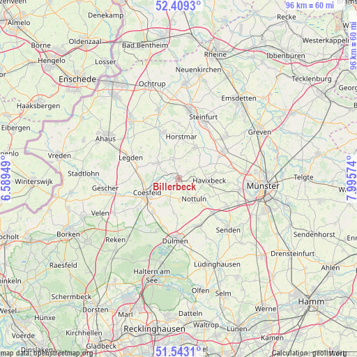
Billerbeck GPS coordinates[2]
51° 58' 41.844" North, 7° 17' 33.396" East
| Map corner | latitude | longitude |
|---|---|---|
| Upper-left | 52.4093°, | 6.58949° |
| Center: | 51.97829°, | 7.29261° |
| Lower-right: | 51.5431°, | 7.99574° |
| Map W x H: | 96.3×96.3 km | = 59.8×59.8mi |
| max Lat: | 55.01917° ⇑28.1% North |
| Billerbeck: | 51.97829° |
| min Lat: | ⇓71.9% South 47.40724° |
| min Long | Billerbeck | max Long |
| 5.92978° | 7.29261° | 14.98853° |
| W 9.9%⇐ | ⇒90.1% E |
Elevation
Elevation of Billerbeck is 116 m = 381 ft, and this is 133.1 m = 437 ft below average elevation for this country.
| Max E: |
1256 m = 4121 ft | 65.7% |
| Avg. | 249.1 m = 817 ft | |
| Billerbeck | 116 m = 381 ft | |
Min E: |
-5 m = -16 ft | 34.3% |
See also: Germany elevation on elevation.city.
Geographical zone
Billerbeck is located in North temperate zone (between Tropic of Cancer and the Arctic Circle). Distance of this North polar circle is 1621.7 km =1007.7 mi to North.| Distance of | km | miles | from Billerbeck |
|---|---|---|---|
| North Pole | 4227.6 | 2626.9 | to North |
| Arctic Circle | 1621.7 | 1007.7 | to North |
| Tropic Cancer | 3173.5 | 1971.9 | to South |
| Equator | 5779.4 | 3591.2 | to South |


Nearby cities:
15 places around Billerbeck: (largest is in red/bold)
• Altenberge
14.3 km =8.9 mi,  56°
56°
• Coesfeld
9.4 km =5.8 mi,  245°
245°
• Dülmen
16.3 km =10.1 mi,  182°
182°
• Gescher
19.9 km =12.4 mi,  262°
262°
• Havixbeck
8.5 km =5.3 mi,  86°
86°
• Heek
20.3 km =12.6 mi,  319°
319°
• Horstmar
11.5 km =7.1 mi,  4°
4°
• Laer
9.7 km =6 mi,  27°
27°
• Legden
14.5 km =9 mi,  294°
294°
• Metelen
19.3 km =12 mi,  343°
343°
• Nordwalde
17.5 km =10.9 mi,  48°
48°
• Nottuln
6.4 km =4 mi,  141°
141°
• Schöppingen
14.1 km =8.8 mi, 343°
• Senden
18.8 km =11.7 mi, 136°
• Steinfurt
19.4 km =12.1 mi,  8°
8°
Sources, notices
• [Note1] Compared only with cities in Germany existing in our database
• [Src1] Map data: © OpenStreetMap contributors (CC-BY-SA)
• [Src2] Other city data from geonames.org with taken over terms of usage.
• [Src3] Geographical zone / Annual Mean Temperature by Robert A. Rohde @ Wikipedia
