Burtenbach geodata
Burtenbach (Bavaria) is a populated place; located in Germany in Europe/Berlin (GMT+2) time zone. With population of 3,323 people, there are 3740 cities with bigger population in this country. Compared to other cities in Germany, 90.8% of cities are located further ↑North; 58.2% of cities are located further ←West and 89.8% of cities have lower elevation than Burtenbach. Note1
Administrative division(s):
- Level 1: Bavaria
- Level 2: Swabia
- Level 3: Landkreis Günzburg
- Level 4: Burtenbach, Markt


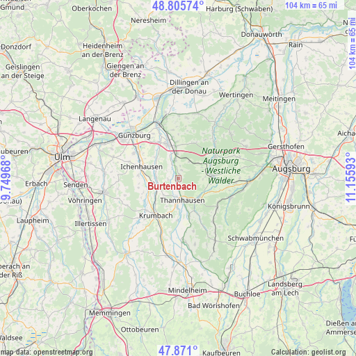
Burtenbach GPS coordinates[2]
48° 20' 25.836" North, 10° 27' 10.08" East
| Map corner | latitude | longitude |
|---|---|---|
| Upper-left | 48.80574°, | 9.74968° |
| Center: | 48.34051°, | 10.4528° |
| Lower-right: | 47.871°, | 11.15593° |
| Map W x H: | 103.9×103.9 km | = 64.6×64.6mi |
| max Lat: | 55.01917° ⇑90.8% North |
| Burtenbach: | 48.34051° |
| min Lat: | ⇓9.2% South 47.40724° |
| min Long | Burtenbach | max Long |
| 5.92978° | 10.4528° | 14.98853° |
| W 58.2%⇐ | ⇒41.8% E |
Elevation
Elevation of Burtenbach is 512 m = 1680 ft, and this is 262.9 m = 863 ft above average elevation for this country.
| Max E: |
1256 m = 4121 ft | 10.2% |
| Burtenbach | 512 m 1680 ft | |
| Avg. | 249.1 m = 817 ft | |
Min E: |
-5 m = -16 ft | 89.8% |
See also: Germany elevation on elevation.city.
Geographical zone
Burtenbach is located in North temperate zone (between Tropic of Cancer and the Arctic Circle). Distance of this North polar circle is 2026.2 km =1259 mi to North.| Distance of | km | miles | from Burtenbach |
|---|---|---|---|
| North Pole | 4632.1 | 2878.3 | to North |
| Arctic Circle | 2026.2 | 1259 | to North |
| Tropic Cancer | 2769 | 1720.6 | to South |
| Equator | 5375 | 3339.9 | to South |


Nearby cities:
15 places around Burtenbach: (largest is in red/bold)
• Balzhausen
11.3 km =7 mi,  164°
164°
• Bayersried
8.9 km =5.5 mi,  181°
181°
• Burgau
10.6 km =6.6 mi,  342°
342°
• Dinkelscherben
10.1 km =6.3 mi,  85°
85°
• Ellzee
9.9 km =6.2 mi,  269°
269°
• Haldenwang
10.8 km =6.7 mi,  358°
358°
• Ichenhausen
11.3 km =7 mi,  287°
287°
• Jettingen-Scheppach
5.6 km =3.5 mi,  348°
348°
• Landensberg
11.7 km =7.3 mi,  26°
26°
• Münsterhausen
3.4 km =2.1 mi, 177°
• Roßhaupten
10 km =6.2 mi,  6°
6°
• Röfingen
9.4 km =5.8 mi, 355°
• Thannhausen
6.5 km =4 mi,  169°
169°
• Ursberg
8.5 km =5.3 mi, 183°
• Ziemetshausen
8.1 km =5 mi,  131°
131°
Sources, notices
• [Note1] Compared only with cities in Germany existing in our database
• [Src1] Map data: © OpenStreetMap contributors (CC-BY-SA)
• [Src2] Other city data from geonames.org with taken over terms of usage.
• [Src3] Geographical zone / Annual Mean Temperature by Robert A. Rohde @ Wikipedia
