Burgsinn geodata
Burgsinn (Bavaria) is a populated place; located in Germany in Europe/Berlin (GMT+2) time zone. With population of 2,709 people, there are 4227 cities with bigger population in this country. Compared to other cities in Germany, 60.2% of cities are located further ↑North; 55.2% of cities are located further →East and 54.4% of cities have higher elevation than Burgsinn. Note1
Administrative division(s):
- Level 1: Bavaria
- Level 2: Regierungsbezirk Unterfranken
- Level 3: Landkreis Main-Spessart
- Level 4: Burgsinn, Markt


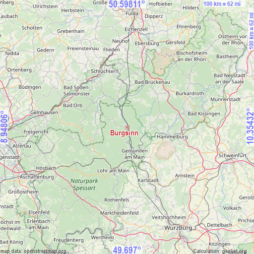
Burgsinn GPS coordinates[2]
50° 8' 58.848" North, 9° 39' 4.284" East
| Map corner | latitude | longitude |
|---|---|---|
| Upper-left | 50.59811°, | 8.94806° |
| Center: | 50.14968°, | 9.65119° |
| Lower-right: | 49.697°, | 10.35432° |
| Map W x H: | 100.2×100.2 km | = 62.3×62.3mi |
| max Lat: | 55.01917° ⇑60.2% North |
| Burgsinn: | 50.14968° |
| min Lat: | ⇓39.8% South 47.40724° |
| min Long | Burgsinn | max Long |
| 5.92978° | 9.65119° | 14.98853° |
| W 44.8%⇐ | ⇒55.2% E |
Elevation
Elevation of Burgsinn is 194 m = 636 ft, and this is 55.1 m = 181 ft below average elevation for this country.
| Max E: |
1256 m = 4121 ft | 54.4% |
| Avg. | 249.1 m = 817 ft | |
| Burgsinn | 194 m = 636 ft | |
Min E: |
-5 m = -16 ft | 45.6% |
See also: Germany elevation on elevation.city.
Geographical zone
Burgsinn is located in North temperate zone (between Tropic of Cancer and the Arctic Circle). Distance of this North polar circle is 1825.1 km =1134.1 mi to North.| Distance of | km | miles | from Burgsinn |
|---|---|---|---|
| North Pole | 4430.9 | 2753.2 | to North |
| Arctic Circle | 1825.1 | 1134.1 | to North |
| Tropic Cancer | 2970.2 | 1845.6 | to South |
| Equator | 5576.1 | 3464.8 | to South |


Nearby cities:
15 places around Burgsinn: (largest is in red/bold)
• Aura im Sinngrund
6.3 km =3.9 mi,  300°
300°
• Fellen
4.8 km =3 mi,  270°
270°
• Frammersbach
16.1 km =10 mi,  233°
233°
• Gemünden am Main
11.8 km =7.3 mi,  160°
160°
• Gräfendorf
7 km =4.3 mi,  115°
115°
• Hammelburg
17.5 km =10.9 mi,  102°
102°
• Karsbach
15.4 km =9.6 mi,  141°
141°
• Mittelsinn
5.3 km =3.3 mi,  332°
332°
• Neuendorf
12.9 km =8 mi,  180°
180°
• Obersinn
7 km =4.3 mi,  338°
338°
• Partenstein
15.2 km =9.4 mi,  217°
217°
• Rieneck
6.3 km =3.9 mi, 182°
• Schönau
9.6 km =6 mi,  148°
148°
• Wartmannsroth
9.6 km =6 mi,  78°
78°
• Zeitlofs
12.6 km =7.8 mi,  6°
6°
Sources, notices
• [Note1] Compared only with cities in Germany existing in our database
• [Src1] Map data: © OpenStreetMap contributors (CC-BY-SA)
• [Src2] Other city data from geonames.org with taken over terms of usage.
• [Src3] Geographical zone / Annual Mean Temperature by Robert A. Rohde @ Wikipedia
