Zeitlofs geodata
Zeitlofs (Bavaria) is a populated place; located in Germany in Europe/Berlin (GMT+2) time zone. With population of 2,228 people, there are 4773 cities with bigger population in this country. Compared to other cities in Germany, 57.6% of cities are located further ↑North; 54.8% of cities are located further →East and 53.2% of cities have lower elevation than Zeitlofs. Note1
Administrative division(s):
- Level 1: Bavaria
- Level 2: Regierungsbezirk Unterfranken
- Level 3: Landkreis Bad Kissingen
- Level 4: Zeitlofs, Markt


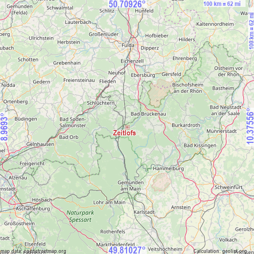
Zeitlofs GPS coordinates[2]
50° 15' 42.804" North, 9° 40' 20.748" East
| Map corner | latitude | longitude |
|---|---|---|
| Upper-left | 50.70926°, | 8.9693° |
| Center: | 50.26189°, | 9.67243° |
| Lower-right: | 49.81027°, | 10.37556° |
| Map W x H: | 100×100 km | = 62.1×62.1mi |
| max Lat: | 55.01917° ⇑57.6% North |
| Zeitlofs: | 50.26189° |
| min Lat: | ⇓42.4% South 47.40724° |
| min Long | Zeitlofs | max Long |
| 5.92978° | 9.67243° | 14.98853° |
| W 45.2%⇐ | ⇒54.8% E |
Elevation
Elevation of Zeitlofs is 248 m = 814 ft, and this is 1.1 m = 4 ft below average elevation for this country.
| Max E: |
1256 m = 4121 ft | 46.8% |
| Avg. | 249.1 m = 817 ft | |
| Zeitlofs | 248 m = 814 ft | |
Min E: |
-5 m = -16 ft | 53.2% |
See also: Germany elevation on elevation.city.
Geographical zone
Zeitlofs is located in North temperate zone (between Tropic of Cancer and the Arctic Circle). Distance of this North polar circle is 1812.6 km =1126.3 mi to North.| Distance of | km | miles | from Zeitlofs |
|---|---|---|---|
| North Pole | 4418.5 | 2745.5 | to North |
| Arctic Circle | 1812.6 | 1126.3 | to North |
| Tropic Cancer | 2982.7 | 1853.4 | to South |
| Equator | 5588.6 | 3472.6 | to South |


Nearby cities:
15 places around Zeitlofs: (largest is in red/bold)
• Aura im Sinngrund
11.6 km =7.2 mi,  216°
216°
• Bad Brückenau
9.8 km =6.1 mi,  58°
58°
• Burgsinn
12.6 km =7.8 mi,  186°
186°
• Fellen
14 km =8.7 mi,  207°
207°
• Geroda
16 km =9.9 mi,  82°
82°
• Gräfendorf
16.2 km =10.1 mi,  162°
162°
• Kalbach
15.9 km =9.9 mi,  2°
2°
• Mittelsinn
8.7 km =5.4 mi, 206°
• Oberleichtersbach
9.4 km =5.8 mi, 75°
• Obersinn
7.2 km =4.5 mi, 214°
• Riedenberg
14.9 km =9.3 mi, 64°
• Schlüchtern
14.2 km =8.8 mi,  312°
312°
• Schondra
13.5 km =8.4 mi,  87°
87°
• Steinau an der Straße
15.9 km =9.9 mi,  291°
291°
• Wartmannsroth
13.2 km =8.2 mi,  143°
143°
Sources, notices
• [Note1] Compared only with cities in Germany existing in our database
• [Src1] Map data: © OpenStreetMap contributors (CC-BY-SA)
• [Src2] Other city data from geonames.org with taken over terms of usage.
• [Src3] Geographical zone / Annual Mean Temperature by Robert A. Rohde @ Wikipedia
