Aura im Sinngrund geodata
Aura im Sinngrund (Bavaria) is a populated place; located in Germany in Europe/Berlin (GMT+2) time zone. With population of 1,063 people, there are 6955 cities with bigger population in this country. Compared to other cities in Germany, 59.5% of cities are located further ↑North; 56.6% of cities are located further →East and 58.8% of cities have lower elevation than Aura im Sinngrund. Note1
Administrative division(s):
- Level 1: Bavaria
- Level 2: Regierungsbezirk Unterfranken
- Level 3: Landkreis Main-Spessart
- Level 4: Aura i.Sinngrund


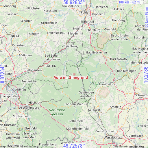
Aura im Sinngrund GPS coordinates[2]
50° 10' 41.484" North, 9° 34' 31.692" East
| Map corner | latitude | longitude |
|---|---|---|
| Upper-left | 50.62635°, | 8.87234° |
| Center: | 50.17819°, | 9.57547° |
| Lower-right: | 49.72578°, | 10.2786° |
| Map W x H: | 100.1×100.1 km | = 62.2×62.2mi |
| max Lat: | 55.01917° ⇑59.5% North |
| Aura im Sinngrund: | 50.17819° |
| min Lat: | ⇓40.5% South 47.40724° |
| min Long | Aura im Sinngru | max Long |
| 5.92978° | 9.57547° | 14.98853° |
| W 43.4%⇐ | ⇒56.6% E |
Elevation
Elevation of Aura im Sinngrund is 283 m = 928 ft, and this is 33.9 m = 111 ft above average elevation for this country.
| Max E: |
1256 m = 4121 ft | 41.2% |
| Aura im Sinngrund | 283 m 928 ft | |
| Avg. | 249.1 m = 817 ft | |
Min E: |
-5 m = -16 ft | 58.8% |
See also: Germany elevation on elevation.city.
Geographical zone
Aura im Sinngrund is located in North temperate zone (between Tropic of Cancer and the Arctic Circle). Distance of this North polar circle is 1821.9 km =1132.1 mi to North.| Distance of | km | miles | from Aura im Sinngrund |
|---|---|---|---|
| North Pole | 4427.8 | 2751.3 | to North |
| Arctic Circle | 1821.9 | 1132.1 | to North |
| Tropic Cancer | 2973.4 | 1847.6 | to South |
| Equator | 5579.3 | 3466.8 | to South |


Nearby cities:
15 places around Aura im Sinngrund: (largest is in red/bold)
• Bad Orb
17.1 km =10.6 mi,  288°
288°
• Burgsinn
6.3 km =3.9 mi,  120°
120°
• Fellen
3.2 km =2 mi,  169°
169°
• Frammersbach
14.7 km =9.1 mi,  211°
211°
• Gemünden am Main
17.1 km =10.6 mi,  146°
146°
• Gräfendorf
13.3 km =8.3 mi, 117°
• Mittelsinn
3.3 km =2.1 mi,  62°
62°
• Neuendorf
17 km =10.6 mi,  161°
161°
• Obersinn
4.4 km =2.7 mi,  39°
39°
• Partenstein
15.7 km =9.8 mi,  194°
194°
• Rieneck
10.7 km =6.6 mi, 151°
• Schönau
15.4 km =9.6 mi,  137°
137°
• Wartmannsroth
14.9 km =9.3 mi,  94°
94°
• Wiesen
16.4 km =10.2 mi,  245°
245°
• Zeitlofs
11.6 km =7.2 mi, 36°
Sources, notices
• [Note1] Compared only with cities in Germany existing in our database
• [Src1] Map data: © OpenStreetMap contributors (CC-BY-SA)
• [Src2] Other city data from geonames.org with taken over terms of usage.
• [Src3] Geographical zone / Annual Mean Temperature by Robert A. Rohde @ Wikipedia
