Bühren geodata
Bühren (Lower Saxony) is a seat of a fourth-order administrative division; located in Germany in Europe/Berlin (GMT+2) time zone. With population of 551 people, there are 9073 cities with bigger population in this country. Compared to other cities in Germany, 66.1% of cities are located further ↓South; 54.7% of cities are located further →East and 57.6% of cities have lower elevation than Bühren. Note1


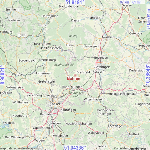
Bühren GPS coordinates[2]
51° 28' 59.988" North, 9° 40' 59.988" East
| Map corner | latitude | longitude |
|---|---|---|
| Upper-left | 51.9191°, | 8.98021° |
| Center: | 51.48333°, | 9.68333° |
| Lower-right: | 51.04336°, | 10.38646° |
| Map W x H: | 97.4×97.4 km | = 60.5×60.5mi |
| max Lat: | 55.01917° ⇑33.9% North |
| Bühren: | 51.48333° |
| min Lat: | ⇓66.1% South 47.40724° |
| min Long | Bühren | max Long |
| 5.92978° | 9.68333° | 14.98853° |
| W 45.3%⇐ | ⇒54.7% E |
Elevation
Elevation of Bühren is 276 m = 906 ft, and this is 26.9 m = 88 ft above average elevation for this country.
| Max E: |
1256 m = 4121 ft | 42.4% |
| Bühren | 276 m 906 ft | |
| Avg. | 249.1 m = 817 ft | |
Min E: |
-5 m = -16 ft | 57.6% |
See also: Germany elevation on elevation.city.
Geographical zone
Bühren is located in North temperate zone (between Tropic of Cancer and the Arctic Circle). Distance of this North polar circle is 1676.8 km =1041.9 mi to North.| Distance of | km | miles | from Bühren |
|---|---|---|---|
| North Pole | 4282.7 | 2661.1 | to North |
| Arctic Circle | 1676.8 | 1041.9 | to North |
| Tropic Cancer | 3118.5 | 1937.7 | to South |
| Equator | 5724.4 | 3557 | to South |


Nearby cities:
15 places around Bühren: (largest is in red/bold)
• Adelebsen
12.1 km =7.5 mi,  24°
24°
• Dransfeld
5.7 km =3.5 mi,  72°
72°
• Espenau
17.6 km =10.9 mi,  236°
236°
• Friedland
17.7 km =11 mi,  113°
113°
• Fuldatal
13.7 km =8.5 mi,  216°
216°
• Gemeinde Friedland
18.8 km =11.7 mi, 113°
• Grebenstein
19.2 km =11.9 mi,  257°
257°
• Göttingen
18.1 km =11.2 mi, 71°
• Hannoversch Münden
7.9 km =4.9 mi,  196°
196°
• Immenhausen
15.4 km =9.6 mi,  246°
246°
• Jühnde
8.3 km =5.2 mi,  102°
102°
• Nieste
18.6 km =11.6 mi,  183°
183°
• Rosdorf
15.1 km =9.4 mi,  82°
82°
• Scheden
5.1 km =3.2 mi,  136°
136°
• Udenhausen
15.4 km =9.6 mi, 261°
Sources, notices
• [Note1] Compared only with cities in Germany existing in our database
• [Src1] Map data: © OpenStreetMap contributors (CC-BY-SA)
• [Src2] Other city data from geonames.org with taken over terms of usage.
• [Src3] Geographical zone / Annual Mean Temperature by Robert A. Rohde @ Wikipedia
