Bruchhausen-Vilsen geodata
Bruchhausen-Vilsen (Lower Saxony) is a populated place; located in Germany in Europe/Berlin (GMT+2) time zone. With population of 6,205 people, there are 2399 cities with bigger population in this country. Compared to other cities in Germany, 80.6% of cities are located further ↓South; 65.5% of cities are located further →East and 91.6% of cities have higher elevation than Bruchhausen-Vilsen. Note1
Administrative division(s):
- Level 1: Lower Saxony
- Level 3: Landkreis Diepholz
- Level 4: Bruchhausen-Vilsen, Flecken


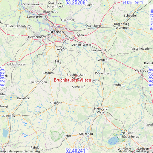
Bruchhausen-Vilsen GPS coordinates[2]
52° 49' 45.516" North, 8° 59' 26.376" East
| Map corner | latitude | longitude |
|---|---|---|
| Upper-left | 53.25206°, | 8.28753° |
| Center: | 52.82931°, | 8.99066° |
| Lower-right: | 52.40241°, | 9.69378° |
| Map W x H: | 94.5×94.5 km | = 58.7×58.7mi |
| max Lat: | 55.01917° ⇑19.4% North |
| Bruchhausen-Vilsen: | 52.82931° |
| min Lat: | ⇓80.6% South 47.40724° |
| min Long | Bruchhausen-Vil | max Long |
| 5.92978° | 8.99066° | 14.98853° |
| W 34.5%⇐ | ⇒65.5% E |
Elevation
Elevation of Bruchhausen-Vilsen is 17 m = 56 ft, and this is 232.1 m = 761 ft below average elevation for this country.
| Max E: |
1256 m = 4121 ft | 91.6% |
| Avg. | 249.1 m = 817 ft | |
| Bruchhausen-Vilsen | 17 m = 56 ft | |
Min E: |
-5 m = -16 ft | 8.4% |
See also: Germany elevation on elevation.city.
Geographical zone
Bruchhausen-Vilsen is located in North temperate zone (between Tropic of Cancer and the Arctic Circle). Distance of this North polar circle is 1527.1 km =948.9 mi to North.| Distance of | km | miles | from Bruchhausen-Vilsen |
|---|---|---|---|
| North Pole | 4133 | 2568.1 | to North |
| Arctic Circle | 1527.1 | 948.9 | to North |
| Tropic Cancer | 3268.1 | 2030.7 | to South |
| Equator | 5874.1 | 3650 | to South |


Nearby cities:
15 places around Bruchhausen-Vilsen: (largest is in red/bold)
• Affinghausen
8.8 km =5.5 mi,  234°
234°
• Asendorf
6.4 km =4 mi,  171°
171°
• Blender
13.6 km =8.5 mi,  44°
44°
• Bücken
11.1 km =6.9 mi,  120°
120°
• Emtinghausen
11.7 km =7.3 mi,  352°
352°
• Engeln
6.3 km =3.9 mi, 230°
• Hilgermissen
12 km =7.5 mi,  78°
78°
• Hoya
10.3 km =6.4 mi,  103°
103°
• Hoyerhagen
6.2 km =3.9 mi,  85°
85°
• Martfeld
7 km =4.3 mi, 42°
• Schwarme
8.1 km =5 mi,  12°
12°
• Staffhorst
12.6 km =7.8 mi,  187°
187°
• Sudwalde
11.1 km =6.9 mi,  248°
248°
• Süstedt
5.8 km =3.6 mi,  308°
308°
• Warpe
13 km =8.1 mi,  145°
145°
Sources, notices
• [Note1] Compared only with cities in Germany existing in our database
• [Src1] Map data: © OpenStreetMap contributors (CC-BY-SA)
• [Src2] Other city data from geonames.org with taken over terms of usage.
• [Src3] Geographical zone / Annual Mean Temperature by Robert A. Rohde @ Wikipedia
